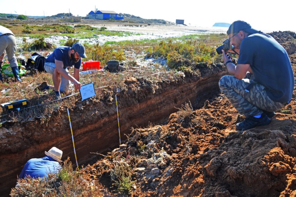
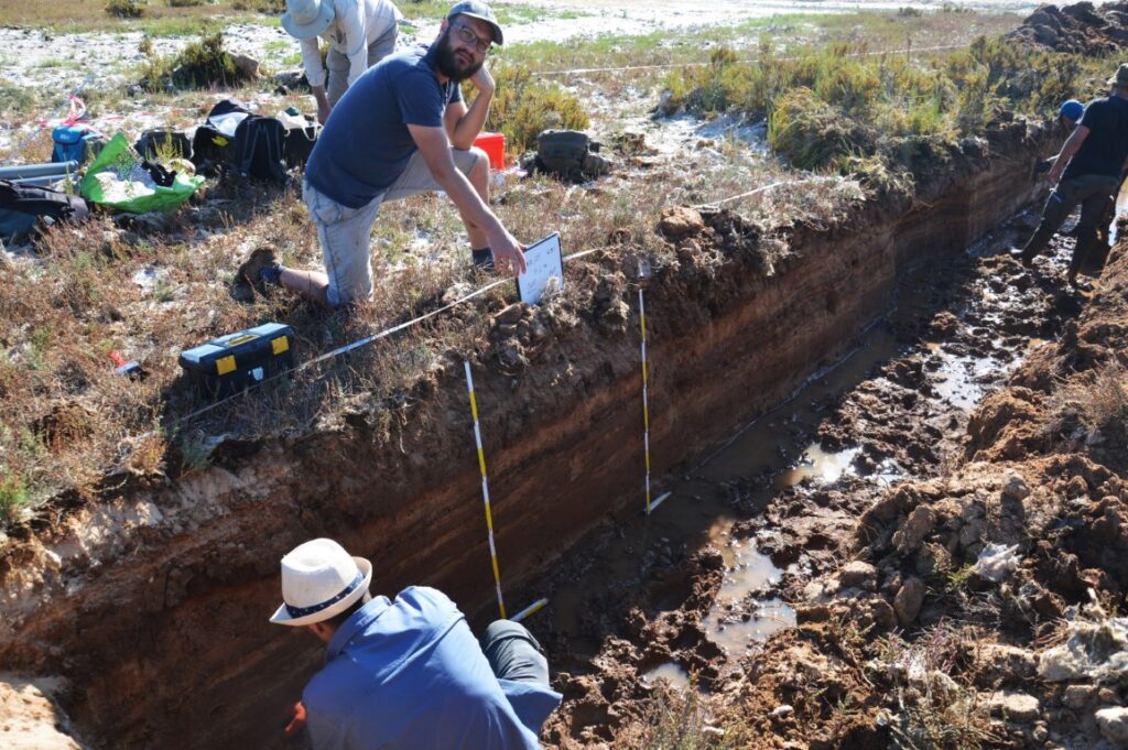
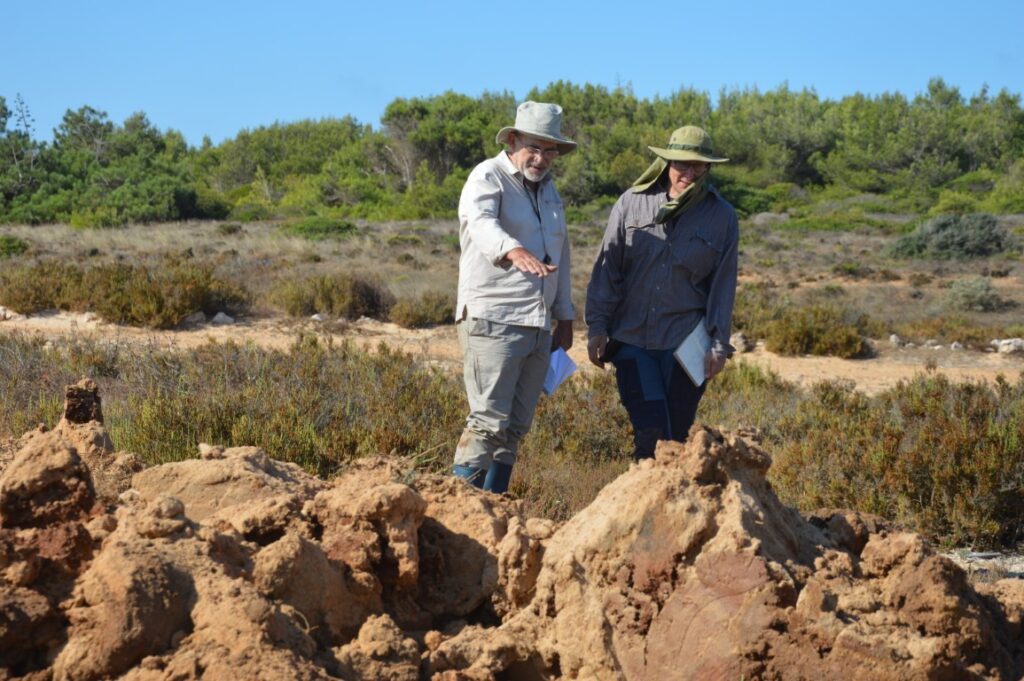
«Do you see that more yellowish sand there, just above the level where the water is now? It is the deposit of the tsunami of 1755». César Andrade, professor and researcher at the Faculty of Sciences of the University of Lisbon, points to the layers of sediment in various shades of brown, which can be seen on the wall of the trench opened on the now dry bottom of Paul do Martinhal, next to the beach of the same name, in Sagres.
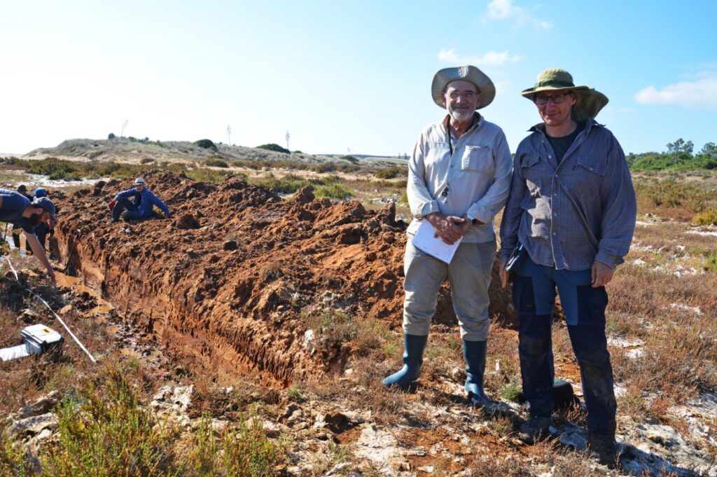
It is here that the efforts of a team of researchers are concentrated, some of them still students, from that Portuguese university, but also from the University of Poznan, in Poland. The project, called TsunaStorm, also involves the University of Coimbra and a university in Switzerland.
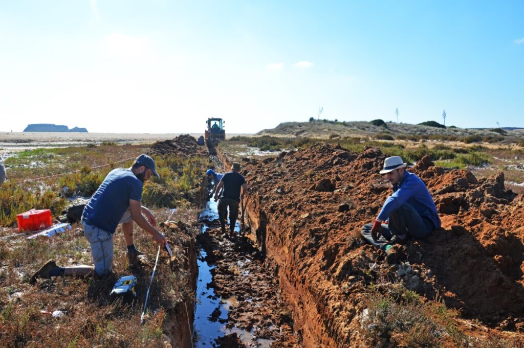
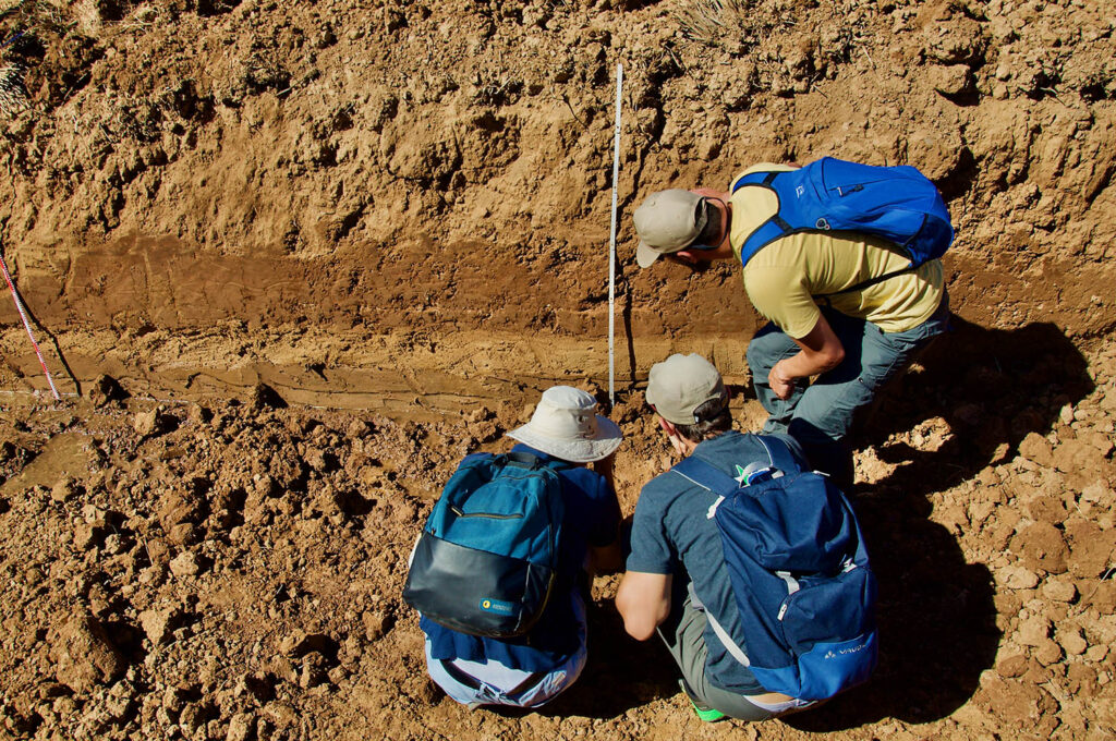
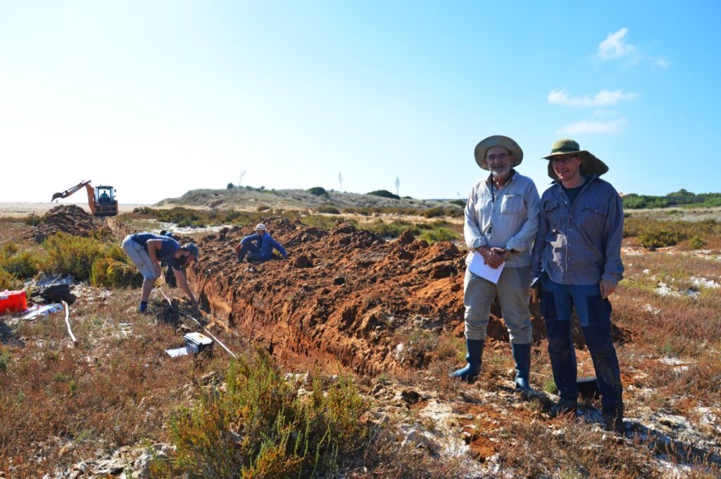
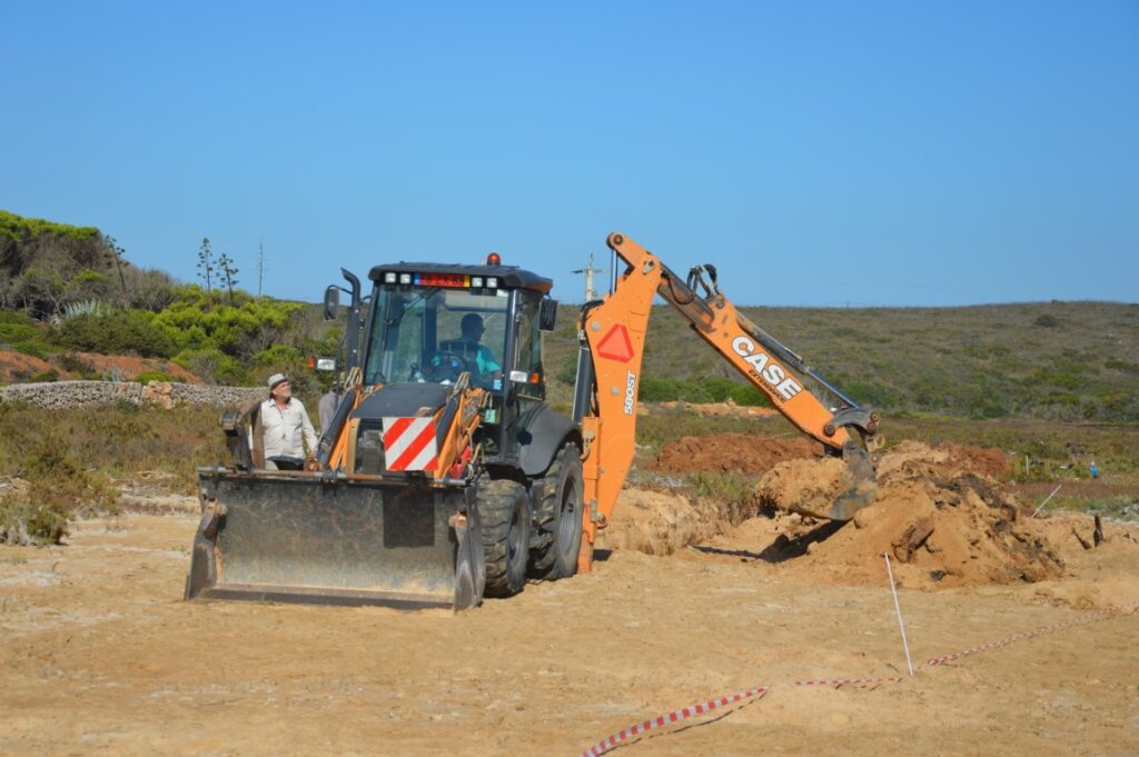
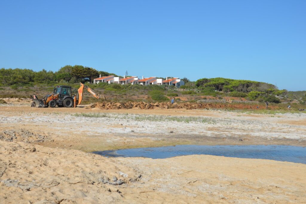
The works started on the 14th and will continue until the 23rd of September. «We started by doing surface prospecting, some holes to identify the best places to place the trenches, then we opened small prospecting trenches by hand and today [last Thursday] is that, with the precious help of the Municipality of Vila do Bishop, we have this machine, which makes our work a lot easier», explained Carlos Andrade to Sul Informação. «Open this by hand would be hours and hours of work, with the machine it's fast».
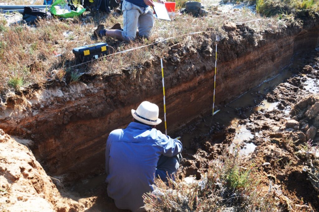
Inside the trench about twenty meters long, opened by the operator of the backhoe machine provided by the Chamber, the investigators, in rubber boots, carefully examine the layers of slightly different colors that can be seen on the side walls of the trench, with a fence. from one meter high, to the water table in the ground. «The fact that the marsh is dry for us is very good, it makes life easier for us», says César Andrade.
The TsunaStorm project aims to make «the characterization of sedimentary deposits caused by tsunamis and storms, allowing to differentiate them through the pioneering use of DNA analysis on molecules deposited in the lithostratigraphic column, making it possible to understand, in a more rigorous way, the impacts, extent and consequences morphodynamics of these events and clearly determine their return periods'.
Translating into a language that everyone can understand, what does that mean? was what the Sul Informação was to find out, on a visit to Paul do Martinhal.
Witold Szczuciński, from the University of Poznan, a specialist in coastal geosciences, begins by explaining that “the world's population is increasingly living in coastal areas. And tsunamis are one of the natural disasters that cause the most victims”, so a risk assessment needs to know more about these phenomena.
The Polish researcher worked in “Thailand, 2004, Japan, 2011”, following the tsunamis that affected these places, but also in Scotland, Greenland, Poland, in all kinds of coastal areas.
At Paul do Martinhal, which is located in a depression along the coast, the work in progress aims to «recognise a tsunami deposit», in other words, the sedimentary traces that remain after a tsunami. But there is a difficulty. Is that these same areas are affected either by sudden floods from land (flood), or by other floods from the sea, caused by ocean storms. The 2014 Hercules storm is the most recent example of an event of the latter kind to leave traces on the coast.
"The key to global research is knowing how to distinguish storm deposits from tsunami deposits, as in both cases sediment is transported from the coastline to land," explained Witold.
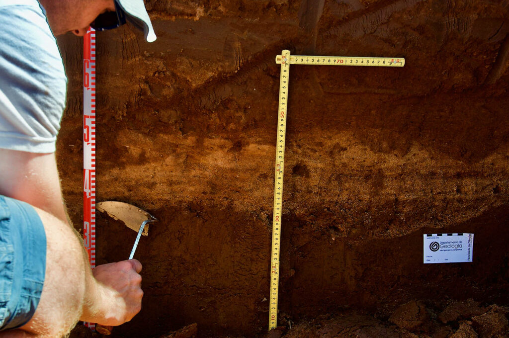
Therefore, what researchers are looking for are "very small differences, such as microfossils, small shells that have to do with the depth of the water, even the DNA of marine organisms that is preserved in the sediments". None of this “can be seen with the naked eye” in the sediment layers, so the collected samples will then be studied in the laboratory.
César Andrade, from the University of Lisbon, adds that this is the continuation of work that has been going on for some years, and that has been taking place «in this depression in Martinhal, but also in other coastal areas of the Algarve, such as Boca do Rio, near here, or, further east on the barrier islands of the Ria Formosa, but also at the mouth of Almargem, near Vale do Lobo (Loulé)».
These are 'coastal depressions' which 'are temporarily inundated by fresh water and occasionally topped by seawater'.
Making a gesture that encompasses the entire Paul do Martinhal, César Andrade emphasizes that «this depression is filled with sedimentary materials that are either terrestrial or marine in origin».
“Whenever the calm sedimentation is interrupted by the impact of high energy waves, very violent storm waves or tsunami waves, these sedimentary materials cover the bottom and then these spaces are again covered by normal sedimentation”, he says.
So, "if we dig a trench or shove a borehole down there, we get a record of flooding over time."
In fact, he explains, «in the specific case of this loss of Martinhal and Boca do Rio, this record goes back in time to around 3, 4 thousand years ago, which is much farther than any instrumental or documentary database ».
This extended time horizon "allows us to see if there have been more floods caused by tsunamis, if there have been tsunamis older than we can remember, how often they have attacked this coastline, whether there are ocean storms or not."
Because, adds the researcher, through the layers of sediments, "we were able to understand how far the seawater flooded these depressions, how many storms there were, or whether the frequency of storms increased or decreased over time."
The data resulting from this assessment “are interesting even for assessing coastal risks, because what happened in the past will be repeated in the future”.
For the scientists involved in the TsunaStorm project, the most exciting thing is that this research has “world-innovative” aspects.
«We are using a set of indicators that range from the study of diatom algae, to foraminifera», in both cases microorganisms preserved in the sediments.
But there is also “a DNA expert, who is using a completely innovative technique, even worldwide, which is to use the DNA strands of microorganisms that are preserved in sediments to detect and separate flood or torrential events, ones coming from the ground. , others from the sea, and, within those of marine origin, separate storm events and tsunami events».
This methodology, guarantees César Andrade, «is completely new: if it is possible to prove it here, since it is this basic idea that finances the project, we hope to be able to apply this methodology in all other countries in the world».

The Portuguese scientist emphasizes that «the elements that were collected and that we will continue to collect in this type of studies are extremely important because, from the knowledge of these elements, we can infer, for example, how high the waves were, how far away the marine marine flood was penetrated ashore. All these indications are extremely useful for the management of coastal risk on the Algarve coast”, which has already suffered the impact of numerous tsunamis over time. And it will certainly suffer again.
On the other hand, he adds, "the knowledge acquired here is later disseminated by the scientific community, originating in Portugal, and ends up being used in coastal risk management in other countries in the world".
And why did the scientists on this international team choose Martinhal as one of their key areas of work?
“Because, on a world scale, it is one of the only places where we find, in the same place, tsunami and storm deposits”, begins by replying the Polish Witold Szczuciński.
César Andrade adds that the «geological framework» of the paul do Martinhal is «the best world record of this type of events», since «there are few places in the world where, in a small area, we can find, simultaneously and in the same space, records of river inundation, tsunami inundation record and storm inundation record'.
«The characteristics of the sediments we found here have transformed this Paul do Martinhal downtown and also the Boca do Rio into pilgrimage sites for scientists from all over the world, from North Americans, people from South America, Chile specifically, Englishmen, Italians , Greeks, Germans. This is the place that researchers look for when they want to see with their eyes a tsunami deposit or a storm deposit, and how it all gets organized».
Basically, the depression along the coast where Paul do Martinhal is located is an immense library full of information, which scientists are now beginning to read.
Once the work on land has been completed, the team, in this case from the universities of Lisbon and Coimbra, will also continue their research at sea, in the coastal area in front of Martinhal. “Just as the tsunami wave entered, it also left and left its signature”, concludes César Andrade. And that's another aspect that the scientists at the TsunaStorm Project want to investigate.
All these works are authorized by the competent authorities, namely the Portuguese Environment Agency and the Sudoeste Alentejano e Costa Vicentina Natural Park.
The project has the support of the Municipality of Vila do Bispo, under a collaboration protocol with the Faculty of Sciences of the University of Lisbon, signed in October 2014.
Photos: Elisabete Rodrigues | Sul Informação


Comments