It has barely started and the geophysical prospecting that has been taking place since Monday on the hill of Castelo de Alferce, in the Monchique mountains, has already allowed two archaeological discoveries: a new tower has been identified and evidence has emerged that the second line of walls it's also shaped like a pentagon, rather than the square it was supposed to be.
A geophysical prospecting of this archaeological site, which dates back at least to the Bronze Age or may even be older (about 5 years ago), it is in charge of a team from the University of Marburg, Germany, coordinated by archaeologist Felix Teichner.
From last Monday until tomorrow, Friday, September 13th, the team will be on the ground, working on a small part of this archaeosite, which, in total, has between "9 to 9,5 hectares", as he explained Fábio Capela, municipal archaeologist who also participates in the works.
The aim is to make “a kind of radiography of the terrain”, in order to indicate to archaeologists where the structures built in ancient times and today hidden underground are to be found, without it being necessary to excavate everything.
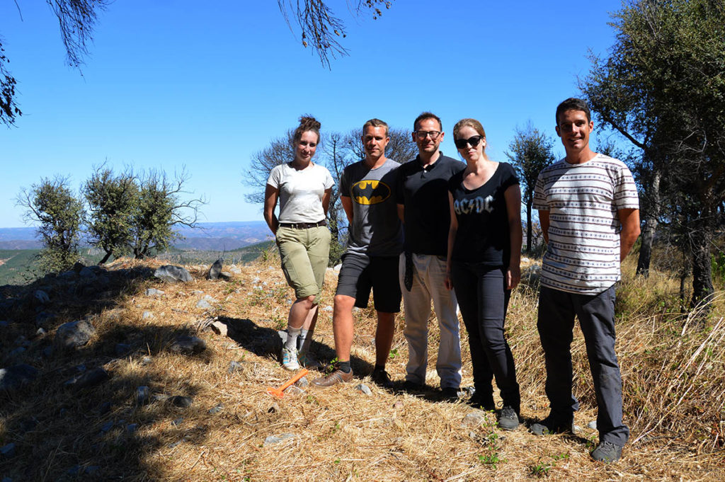
Yesterday afternoon, when the Sul Informação he visited the site, Felix Teichner was away, working on another archaeological campaign in progress in the Algarve (in Boca do Rio), so Thomas Schierl and Anna Jankowiak were speaking to our report.
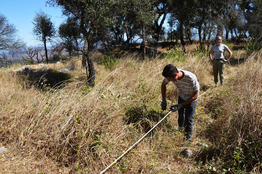
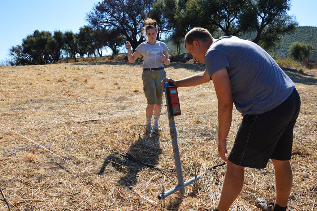
After less than three days of work, Anna Jankowiak was already happy with the "promising results". The task of researchers from the German university, equipped with their equipment, is above all to "locate the buried structures, namely the walls and walls" and confirm (or not) whether the entrance to the inner walled precinct – the so-called ninth-century fortress of the Emirate-Omiad period - is located in the place where the archaeologists led by Fábio Capela identified it in the 2017 excavation campaign.
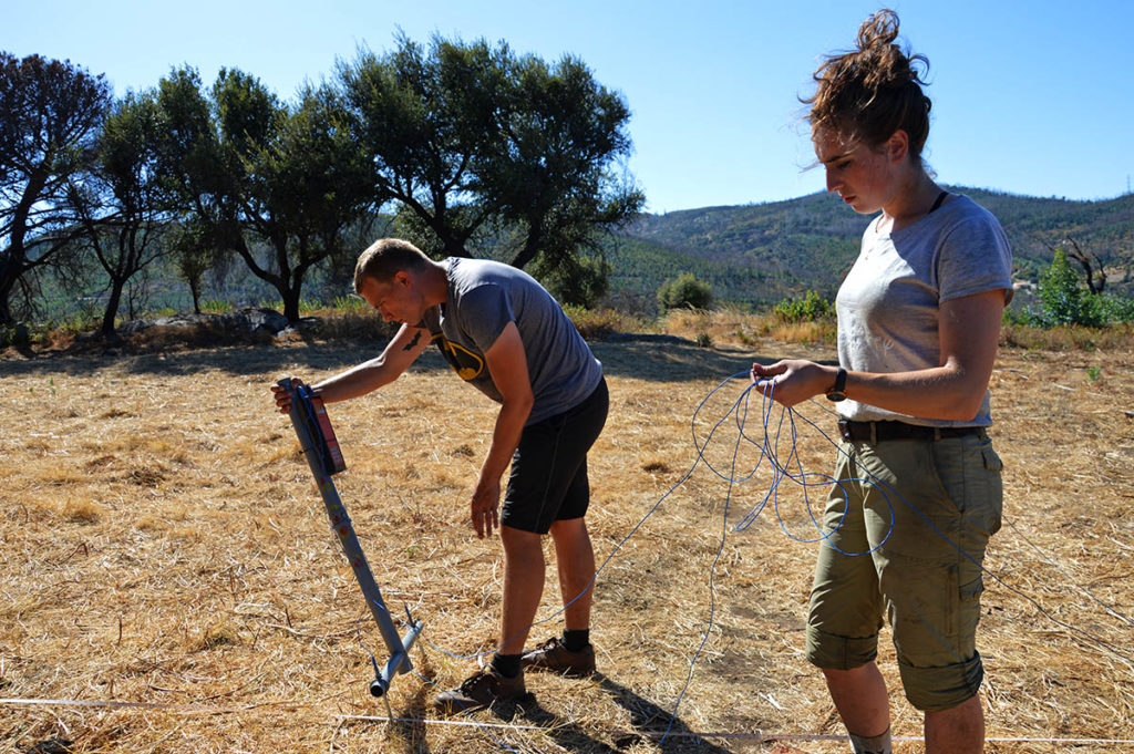
What is intended, by crossing different methods of geophysical prospecting, one of them the georadar, is "to uncover evidence of structures and other "anomalies" of human origin hidden underground," added Thomas Schierl.
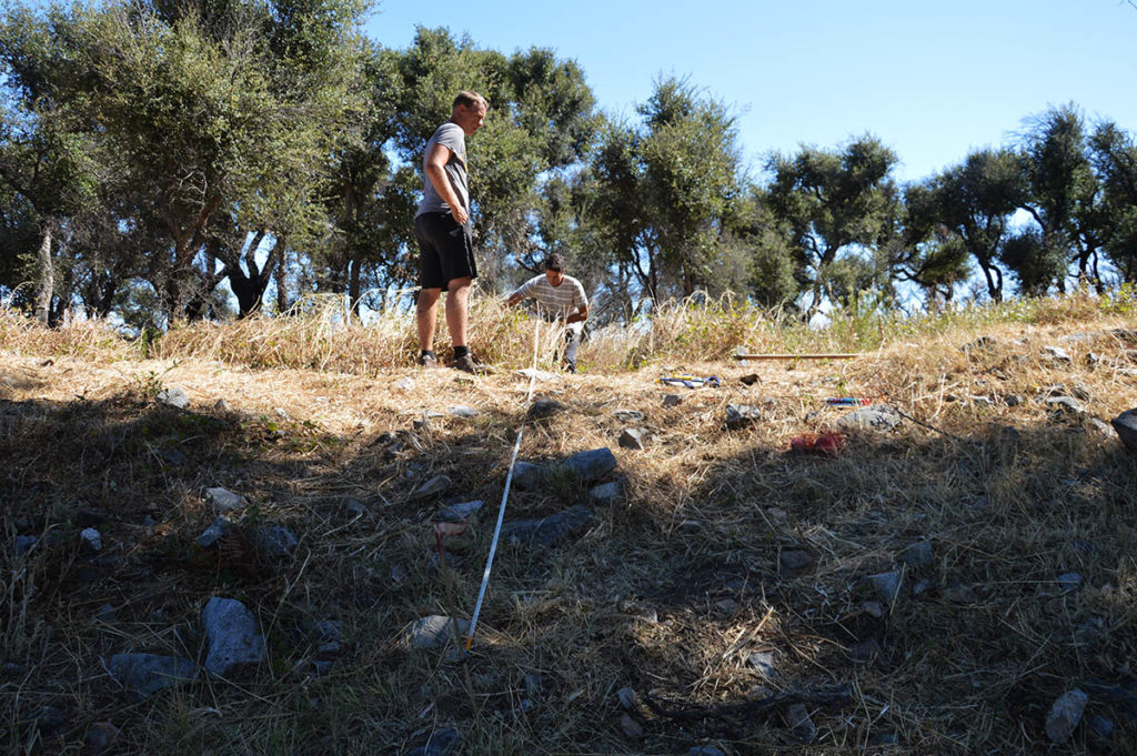
While the conversation is taking place, the two German students, who are also part of the six-person team from the University of Marburg, are holding a measuring tape in hand marking the places from which they will be placed on the ground, at regular spaces of 50 centimeters, a a kind of metallic probes, connected to each other and to a device by blue electrical wires. «Yesterday it was difficult, it was cold and windy here, but today it is good weather, warmer, without exaggeration», commented Fábio Capela.
The research with georadar, on the other hand, will allow the collection of data that will later enable the construction of «a 3D image of the underground structures existing underground», making a «reconstruction in area and in depth», explained Thomas Schierl.
And what advantages do these geophysical prospecting methods have over traditional archaeological excavations? “They save a lot of time, because archaeologists, for example, might see the foundation of a house or the location of a wall and decide that they're just going to dig there,” says Thomas.
But there are also other advantages: "knowing where the likely structures are, archaeologists will only dig in chosen sites and not dig everything, to a large extent, thus avoiding destroying the entire archaeological site", adds Anna. It is because, stresses the young archaeologist, "all archaeological excavation is destruction." Thus, researchers will be able to leave some areas of the archaeosite where they are working "for later", when techniques and technologies are even more advanced. "With the information we gather through geophysical prospecting and data interpretation, we can dig, but leaving parts to be investigated in the future."
For now, in the immediate term, the team continues to work on the hill of Castelo de Alferce, a short distance from the village, trying to collect, in an intense five days, the maximum amount of geophysical data, «electronic and topographic information». Then follows a long analysis and interpretation of these data, in the laboratory, when they return to the University of Marburg, Germany.
«Don't think that what we are doing here now gives us, immediately, complete and direct images of what exists here. We will have months of work when we return to the university, processing and crossing these data, with the help of the much more powerful computers we have there. Here, in the field, we only have a few small computers that are used to download the data that we are collecting, but they do not have the power to analyze, process and cross-reference them. We collect a lot, a lot of data, then we need good computers to process it,” says Thomas Schierl.
Both Thomas and Anna Jankowiak already have experience in Portuguese archaeological sites. Anna, by the way, did her doctoral thesis on the Romans in Portugal. But this hill at Castelo de Alferce has some characteristics that are very pleasing to young archaeologists from the German university: «we know many Roman and Islamic sites in Portugal, but here we are facing a transition period, between the later Romans or even peoples of the Visigothic period and the first Islamic occupation. It's very interesting!” says Thomas.
Also the area of the prehistoric settlement, possibly from the beginning of the Bronze Age, or even earlier, of the Late Chalcolithic (end of the 3rd millennium, beginning of the 2nd millennium BC), "which seems to have been very large", excites the German team.
Fábio Capela, an archaeologist from the Municipality of Monchique, has been on the ground every day, giving support to the team, but also ensuring the connection between researchers from the University of Marburg and those from the University of Algarve. The Castelo de Alferce hill is clearly the apple of his eye as far as Monchique's archaeological heritage is concerned, and that is why Fábio speaks of this site with great enthusiasm.
And there are reasons for that, since, from the archaeological excavations that have been carried out in recent times at Castelo de Alferce, especially in the 2017 campaign, new data have emerged.
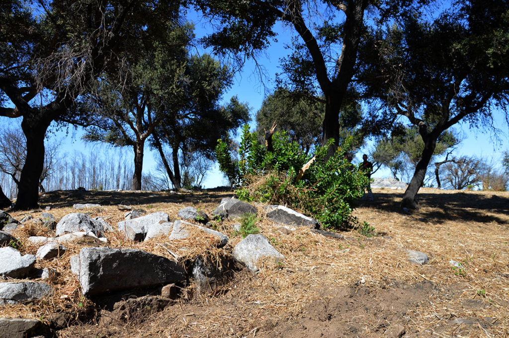
The oldest plants, he recalls, “always show a square castle. But in 2004, when the excavations of the Franco-Belgian team took place here, they determined that after all the fortress [the central area, a kind of last stronghold of the castle] was pentagonal and not quadrangular». This was confirmed in the 2017 excavations, which took place under the direction of Fábio Capela. "We confirmed that there is an inflection of the wall to the south and that the fortress was pentagonal", he recalled, to the Sul Informação.
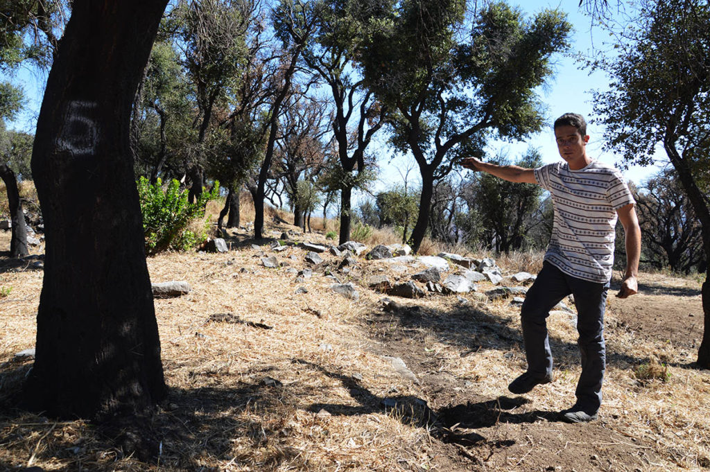
"Following these excavations and last year's fire, which burned the vegetation and left more structures in sight, we were able to define that almost all segments had three square towers, adjacent to the outside of the wall."
But the most interesting thing was to discover, thanks to the combination of superficial observation and preliminary geophysical data, that the second line of walls, outside the fortress, is also pentagonal in shape, that is, it is a wall with five sides and not four. , as thought.
But the orientation of this fifth section of the second line of walls is to the west, while in the fortress it was to the east. "Why? We do not know. Was it for military reasons? To adapt to the terrain? On the whim of the architect who built it?”, asks Fábio Capela.
Current geophysical surveys also aim to determine the location of the entrance to the second walled enclosure. “We thought it would be in a place, but now we find that there is another large tower beside the inner wall. This is unprecedented data», says the municipal archaeologist.
Even more interesting is that, in this place, the second line of walls passes very close to the tower now discovered, which gives rise to new hypotheses. “Did they taper the wall so that the entrance could be here?”, asks Fábio Capela. "I don't know any parallels, but you never know," he adds enthusiastically.
This year, the geophysical prospecting will be the only field work taking place at the archaeological site of Castelo de Alferce hill. But a Multiannual Research Project in Archeology (PIPA) is already in its final phase, to be submitted in 2020 for approval by the Directorate-General for Cultural Heritage, involving the Municipality of Monchique and the Universities of Algarve and Marburgo, as well as other consultants to be able to define a work to four years of systematic investigation in this important archeosite.
“If our PIPA is approved, we will be able to have excavations here for four years. Instead of just drilling in a few places, like so far, we could dig in extension. There is even the possibility of having an international archaeological field, with the collaboration of the universities of the Algarve, Marburg and even Coimbra», explained Fábio Capela.
On another front, the Municipality of Monchique is also finalizing an application to CRESC Algarve 2020, for tourism enhancement. Chamber president Rui André had already explained to the Sul Informação that this application includes the creation of signposted interpretation routes on the Castelo hill, as well as an Interpretative Center in Alferce and also a pedestrian route that connects the village to the archaeosite, passing by the neighboring Barranco do Demo, with geological formations from great interest and populated by legends and superstitions.
Archaeologist Anna Jankowiak welcomed this idea of integrating the hill and its important remains “in a heritage route”. "It's good that everyone, not just us researchers, can get to know what exists here."
Photos: Elisabete Rodrigues | Sul Informação


Comments