The Navy and the National Maritime Authority today recommended to the maritime community and the population in general a “state of permanent surveillance” at sea and in coastal areas, due to the worsening weather conditions forecast for Thursday.
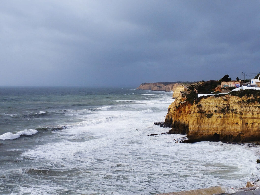
In a statement, authorities warned that the sea disturbance will be characterized by swells coming from the northwest, with waves that can reach eight meters and a maximum height of 14 meters.
The wind may register an average intensity of up to 65 kilometers/hour and gusts of up to 120 kilometers/hour, coming from the northwest quadrant.
A worsening of weather conditions and sea disturbances is expected on the western coast of mainland Portugal between 6am on Thursday and 00am on Monday.
Therefore, the Navy and the National Maritime Authority recommend reinforcing mooring and maintaining close surveillance of moored and anchored vessels, in addition to avoiding walks along the sea, near port protection jetties, on cliffs and beaches, and recreational activities in the most exposed areas.
«Recreational fishing is strongly discouraged, especially near cliffs and cliff areas on coastal fronts affected by breaking waves, always bearing in mind that in these conditions the sea can easily reach apparently safe areas», says the note.
The National Emergency and Civil Protection Authority (ANEPC) also warned on Tuesday of the worsening of weather conditions in the next 48 hours, with rain, strong winds, sea disturbances and snowfall, especially in the center and north of the country.
Based on forecasts from the Portuguese Institute of the Sea and Atmosphere, ANEPC warned of precipitation today, especially in the north and central coastal regions, from the end of the afternoon, and of a gradual increase in wind intensity, blowing at times strong in the coastal strip and in the highlands.
For Thursday, the rain will extend across the entire continental territory, but with particular intensity in the north and center and in mountainous areas, with snowfall expected in the highest points of the Serra da Estrela.
For Thursday, strong winds are also expected to predominate from the western quadrant, gradually increasing in intensity and sometimes blowing strongly in the coastal strip and highlands, with gusts of up to 70 kilometers per hour, as well as a gradual increase in sea agitation, with worsening from early in the morning.
On the mainland, the districts of Faro, Porto, Setúbal, Viana do Castelo, Lisbon, Leiria, Beja, Aveiro, Coimbra and Braga will be under yellow warning between 9am and 00pm on Thursday, then turning to orange between 18pm on Thursday and 00am on Friday -fair.
The north coast of the island of Madeira and Porto Santo will be under yellow warning between 3:00 am and 9:00 am on Thursday, then turning to orange between 9:00 am on Thursday and 00:00 am on Friday.
Porto Santo and the north coast of Madeira will then go under yellow warning between 00:00 and 6:00 on Friday.
The orange warning (the second most serious on a scale of three) is issued by IPMA whenever there is a “moderate to high risk meteorological situation and yellow (the least serious) when there is a risk situation for certain activities dependent on the meteorological situation” .


Comments