Sometimes strong showers and may be accompanied by some thunder, hail and gusts associated with more intense cells, especially in the Central Coast, being weaker in the South, in a situation that, during the late morning and afternoon, may also extend to the North. This is the weather forecast for this Monday, the 11th of May, according to the Meteophons website.
The situation is caused by the approach of a first depression, which tonight will be leaning against the western coast of the continent. «This depression will then be absorbed by another depression that is also active, which will be located in the West of the Continent on Wednesday, coming even closer on Thursday and Friday, when it will dissipate/remove to the East and Southeast ».
As a result of this, the Portuguese Institute of the Sea and Atmosphere has already placed the entire western coast, namely the districts of Beja and Faro, under yellow warning, due to maritime agitation, forecasting westward waves with 4 to 4,5 meters.
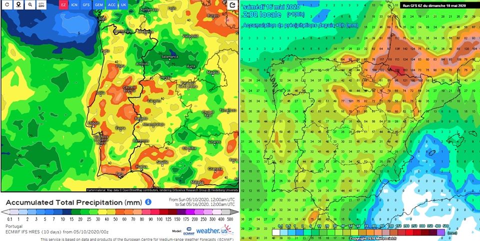
But the weather will be rainier, especially on Wednesday, the 13th, when periods of rain or moderate to heavy showers are expected, especially in the Center and South, which may be accompanied by thunder in some places and eventual hail and gusts stronger.
Thursday, according to the website Meteofontes, will be «again a day marked by periods of rain or sometimes heavy showers, with the possibility of thunderstorms in some places. On Friday, the showers will decrease in intensity and frequency starting in the afternoon. For Saturday, “a day without many clouds and without rain is foreseen”.


Comments