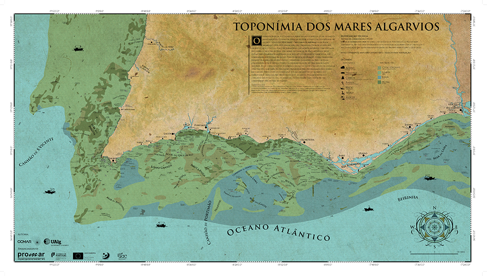
 South of Carvoeiro is Greenland and between Burgau and Lagos is the Black Sea. There is also a Makro Corridor located on the high seas, very close to the Chorizo Sea and the Couve Sea. Do not believe? Ask a fisherman, or consult the Toponymy Map of the Algarve Seas, released last Friday by CCMAR, from the University of Algarve.
This pioneering project compiled the knowledge of several generations of Algarve fishermen who gave names to the rocks and the “seas” and showed them on a map, so that this wisdom, which passed from mouth to mouth from parents to children, is not lost.
“If every land area has a name, whether it's a hotel or a tourist area, why shouldn't the sea have streets or areas with names?”, asks Júlio Alhinho, a fisherman from Quarteira for over 40 years , who participated in the project and helped to validate the more than 500 locations marked on the map.
«The stones, already in my father's time, had been baptized. They had the names of people, people went there to fish and the stone, which had no name at all, had the names of the people who used to go there to fish. Maybe when I die, there will be a stone with my name on it», he jokes.
Júlio Alhinho finds the project “curious. Before, people talked about names and people didn't know where it was, where we were going to fish, now they know, with this map they have a better idea».
The 58-year-old fisherman doesn't need a map to navigate a sea he knows “better than my house, it's funny. I know many of these names on the map, but I don't know the name of my street!».
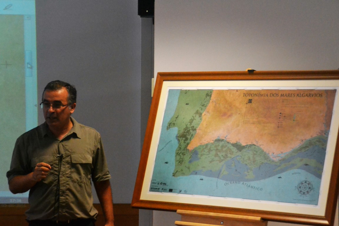
The CCMAR project was coordinated by Jorge Gonçalves, who says that «we had more than 7 entries, which were reduced to around 500 designations». These 7 entries were obtained over the course of a year, going from port to port, from Arrifana to Vila Real de Santo António, talking to more than 200 fishermen. Many of them did not want to miss the launch of the map and filled the seminar room of the Rectory of the University of Algarve.
The researcher explains that, for these names given by the fishing communities, “there are several causes, it has to do with the type of funds… for example, in Parte e Rasga it is easy to understand that nets should not be used there. The Makro Corridor is explained by the fact that 20 years ago, without GPS, fishermen removed the alignments and threads, using earth marks and Makro, in Albufeira, was an imposing construction at the time. There are also names related to fishing objects, such as the Sea of Sargos and with names of fishermen, such as Joaquim Tomás».
More than a map that arouses curiosity in people, this project is, according to Jorge Gonçalves, «a port of information for the fishing community that is now accessible to everyone».
The map shows, for example, places where shipwrecks have occurred and their signage brings benefits «for diving, water tourism and some may even have archaeological interest».
The knowledge produced by CCMAR is often used by fishermen, but in this case, the opposite happened: «the first point in this project is the valorization of fishing communities and their knowledge. We at universities are seen as being on a pedestal, removed from the community, but this connection has been growing closer and this is one of the best examples. This map is a tribute to fishermen and the fishing community», concludes Jorge Gonçalves.
Use the map below to navigate through «seas never mapped before» and take the opportunity to find out where the Mar do Gelo, Mar das Estevas or Mar do Feijão is located.


Comments