Wind gusts of 109 km/h were recorded at the Castro Marim meteorological station, at 16 pm on Sunday, October 22, when extratropical storm Bernard passed through the Algarve, the Portuguese Institute of the Sea and Atmosphere revealed today ( IPMA).
The SIO (Integrated Observation System) at the Airport of Faro, at 14:30 pm on Saturday, recorded a gust of 25.3 m/s (91 km/h), while the Olhão station recorded, at 15:20 pm, 24.9 m/s (90 km/h).
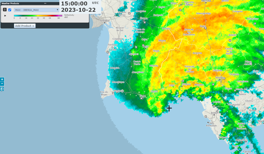
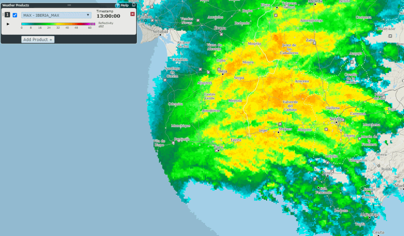
The IPMA adds that «as storm Bernard approached the south of mainland Portugal, it was found that the nucleus was always located over the sea», as can be seen in the figure above, which results from images from Iberian radars, highlighting the observations from the Seville radar, which shows the evolution of the “Bernard” storm in the period between 13:00 pm and 18:00 pm.
The strongest instantaneous maximum wind values (gust) were observed in places located close to the sea, «as the depression spread from west-southwest to east-northeast».
But the IPMA admits that «in other parts of the territory, gust values with a magnitude greater than those mentioned may have been reached».
In the neighboring region of Andalusia (Spain), very strong winds were also observed near the storm's core, with gusts exceeding 110 km/h recorded in several places.
The name Bernard was given by IPMA to the extratropical storm, «in accordance with the criteria in force for the purpose, with a view to drawing the attention of the population and the media to the prevention and safeguarding of lives and property in situations of risk, in conjunction with the Civil Protection structure».
This storm had an impact on the Azores and Madeira archipelagos and, in particular, in the south of the mainland, where precipitation and strong winds occurred in several places.
«Forecasting the incidence of the various meteorological phenomena associated with this type of system requires as accurate knowledge as possible of its trajectory», explains IPMA.
«Among the areas most likely to be affected by strong winds during the most severe phase of the disturbance are usually those located in the vicinity of the respective nucleus, which makes its monitoring particularly sensitive and relevant» , he adds.
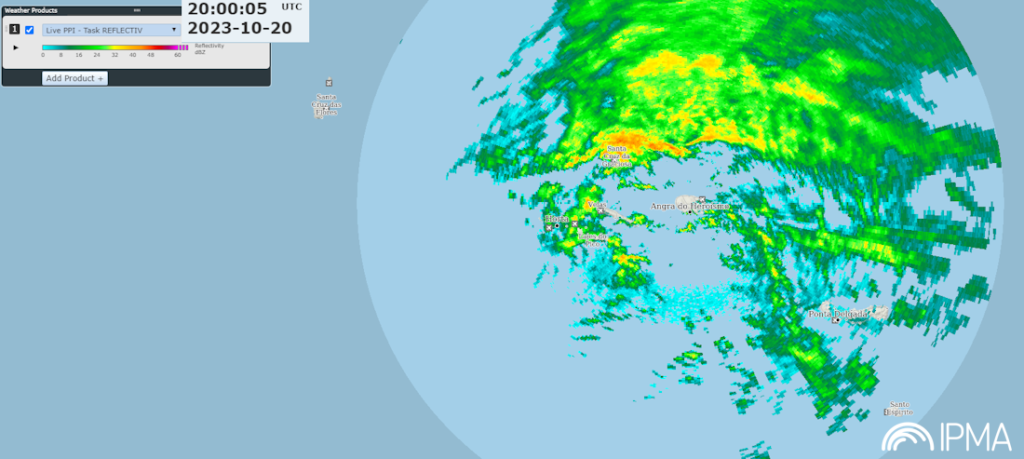
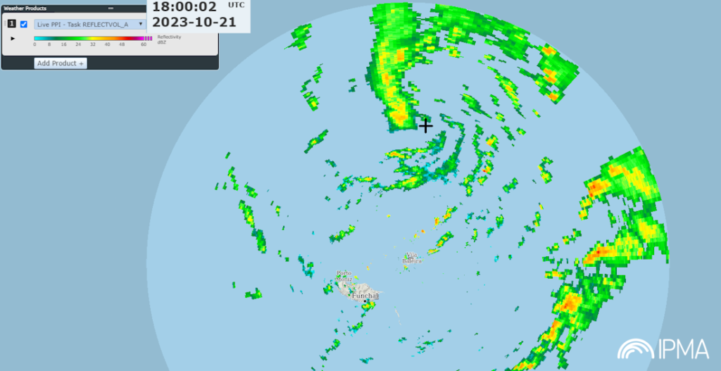
It was possible to follow this storm, as it spread, using observations from meteorological radars in Terceira/S. Bárbara (TRC, Azores), Porto Santo/P. Espigão (PST, Madeira) and by the Spanish radar in Seville, in the latter case under the OPERA Program, from EUMETNET.
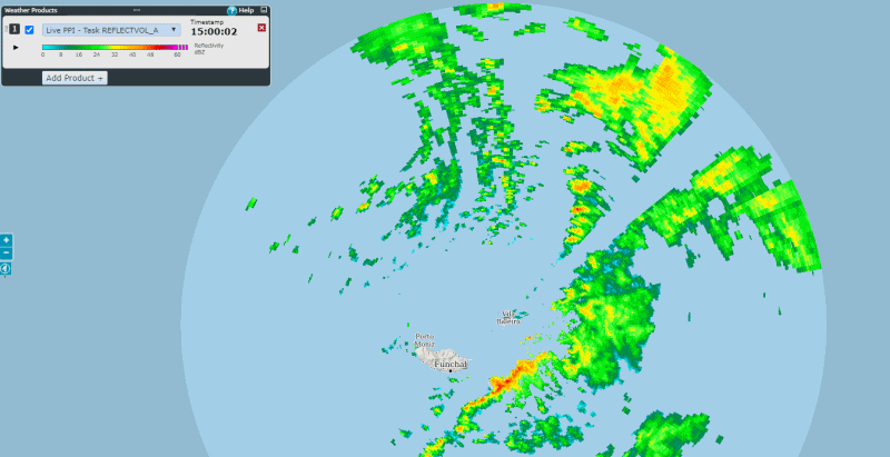
The TRC radar observed the storm on October 20th (Figure 1, see the gallery below), the PST radar on the 21st (Figure 2) and the Seville radar on October 22nd (Figure 3), depending on the positioning of the storm. depression.
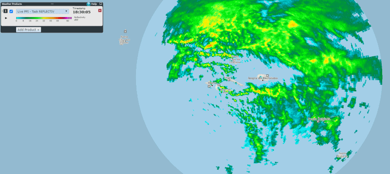
«It is interesting to follow the evolution that this storm revealed over time, when it was in the coverage area of each of the mentioned radar systems, namely through the animations available from TRC (Figure 4), PST (Figure 5) and Seville (Figure 6)».
The passage of the Bernard depression across the continent also caused strong maritime agitation, as Sul Informação already reported, indicating the maximum wave height in Faro, Sines, Nazaré and Leixões.


Comments