The North American Space Agency (NASA) approved the project “Assessing the usefulness of ICESat-2 data for wildland fuel mapping”, led by Sérgio Godinho, researcher at the Remote Sensing Laboratory (EarsLab) of the Institute of Earth Sciences (ICT) of the University of Évora (UÉ).
This project intends, using remote sensing, to develop innovative methods to map forest fuels and obtain essential cartography to support the planning and management of forest fire prevention and suppression activities.
Testing and combining a set of methodologies that allow translating the laser signal emitted and recorded by the ICESat-2 satellite into quantitative information, obtaining precise data on the structure and quantity of vegetation on the Earth's surface is the objective of the project developed under the program "ICESat-2 Applied Users Program” from NASA.
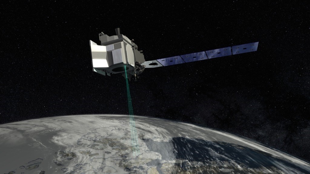
This NASA satellite, launched in 2018, has state-of-the-art technology that allows it to create a three-dimensional global portrait of our planet.
Orbiting at almost 500 kilometers, the ICESat-2 makes it possible to map our planet and the characteristics of the territory with extreme precision, which allows scientists, through the data obtained, to monitor changes in the terrain, including the melting of glaciers, the rise in sea levels or changes in vegetation.
It is in this last area that the project led by Sérgio Godinho, recently approved by NASA, is included. The sensor "Advanced Topographic Laser Altimeter System (ATLAS)”, aboard the ICESat-2 satellite, sends laser pulses to the Earth's surface and collects, through a telescope, the photons that are reflected back into space.
By recording the travel time of photons between the Earth's surface and the telescope, ATLAS converts that time into distance traveled using the speed constant of light.
Knowing the exact position of the ICESat-2, through a high-precision GPS incorporated in the system, the distance covered by the photons is converted into height, that is, for each photon registered it will be associated with its coordinate and altitude.
Based on this information, researchers will be able to reconstruct the vertical profile of the vegetation, which will generate a set of variables, such as the height of the crowns or height of the crown base, among others, and later estimate the amount of above-ground biomass. .
The project coordinator at UÉ highlights the importance of this project, which will allow, over the next three years, “collaboration with some of the best researchers and scientists in the world of LiDAR technology from space, but which will also be a way of designing the name of the UÉ, giving visibility to the specialized investigation of forest fires, a pressing issue of contemporary society”.
LiDAR is the English abbreviation for Light Detection and Ranging ou Laser Imaging Detection and Ranging.
The “ICESat-2 Applied Users Program” intends to assess how the ICESat-2 space mission can generate a direct benefit to society in different areas (forests, agriculture, biodiversity, atmosphere, etc.).
For this purpose, NASA selected a set of research projects aimed at testing, calibrating and validating ICESat-2 data for different scientific applications, with the project submitted by the ICT researcher being one of those awarded.
![]()


Comments