
Now that summer is at its end, when the Algarve region – in particular its fringe coastline – sees thousands of tourists departing for winter pastures (in a transhumance that began five decades ago), it is time to cool down the head, to consolidate goals, to arrange ideas and to write about a magazine cover published in the last week of August, entitled «THE LAST PARADISE OF THE ALGARVE», with the printed image corresponding to an aerial view of the Ria Formosa, the section that starts in Cacela-Velha appears in the foreground, having as a vanishing point the area near Cabanas de Tavira.
The summer, in almost its entirety, encompassing the months of July and August, is called Silly season for various reasons, but equally because of the characteristic of being produced pieces of journalistic content whose approach is superficial, sinning more by omission than by the chosen elements where the analysis falls.
If the choice of matter to be analyzed and targeted can only meet, or not, a personal taste, the omission and/or the deliberate lack of certain elements is harmful, because it not only induces error, but also perpetuates it. .
Thus, what appears on the cover of the aforementioned magazine is a title associated with an image, it is a concept perpetuated for decades in which Paradise on Earth is associated with the coast, the sand and its adjacent areas.
Everything would be fine, even if I weren't (but I'm already immune to this association and I make it revert in my favor, when it suits me), and I wouldn't have felt this pressing need to write, if it weren't for the title being associated with that image, in the image of the coast of Cacela-Velha. I will explain the reasons that cause me so much concern:
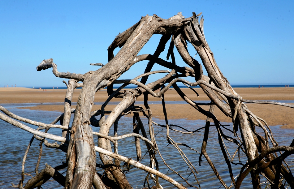
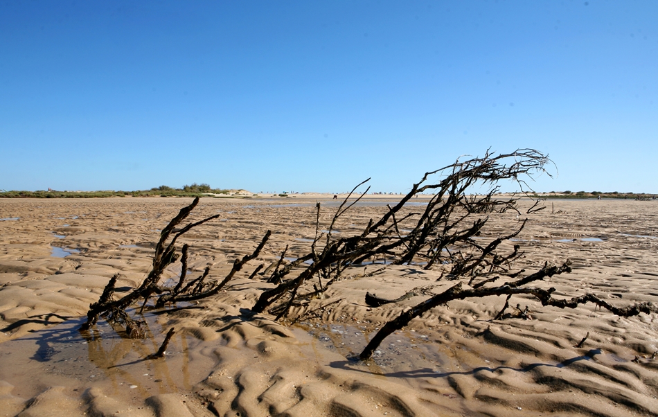
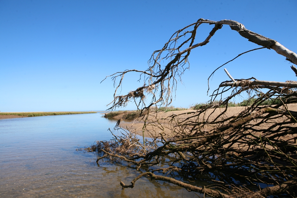
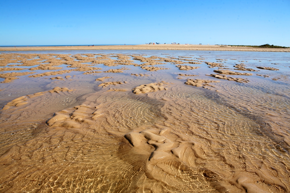
- the above-mentioned image I think is not current, having been captured at least a year ago, as the structures of the oyster pond are still visible in it - whose existence is already in danger with the siltation of the estuary - was razed this year with the storm that effortlessly passed what was left of the old dune cord.
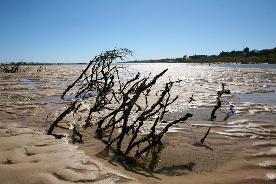
– the cover image falsely conveys the existence of a healthy dune cord filled and fortified by vegetation, which in fact does not happen.
A few meters away from the eastern end of the remaining dune cordon, the vegetation disappears completely and the remaining elevation of sand fades away, being pushed into the estuary with each passing year.
– Cacela-Velha, the Relíquia, being bathed by the Ria Formosa, had a wall in the dune cordon, a first bastion, where, at times, the strongest undulation faded away, protecting not only the lagoon system, but also the foundation of the village itself.
With mutational characteristics over time, it was, however, through the erosive action of human beings that, in a short space of time, its existence was threatened.
A few years ago, suffering from silting, he was the target of an artificial opening of a bar, not where it was naturally opening (witnessed by residents), but in an opposite place, more to the east, having been described by them as a error, a fact that shortly afterward was easily verifiable, ending up weakening the continuous line of the dune cord.
However, I also want to believe that the APA technicians should have studies and documents in their possession, proving that there would, in fact, be the best place to open communication with the vast Ocean, and that soon, in an astonishing turn, the whole the situation will naturally reverse...

– Cacela-Velha, the Wonder, the Pearl, the Paradise, has five inhabitants, five. Sometimes there are one or two houses for sale, and the price is set at present for a more modest and popularly inspired space, at an expensive 450.000 euros. The houses are, therefore, fully lived, enjoyed, one to two months a year, naturally coinciding with the summer period.
On the other hand, the Cemetery expands as it can, towards infinity, to serve not Cacela-Velha, but a whole vast Parish.
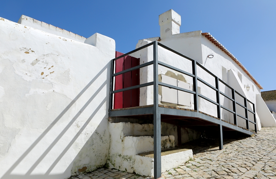
– Cacela-Velha, the Pearl, has cement applied to the centuries-old walls of its Fort, in no way contrasting with the fey modern sculpture implanted between it and the Church.

– Cacela-Velha, the Oasis, has at its entrance a restaurant that has an esplanade that skips the road and above, on the roof, a heavy and visible shading structure was installed, so that warmer bodies can settle around a well-deserved Mediterranean meal.
– Cacela-Velha, the village classified as a Property of Public Interest, having included a group of 11 villages, was the target of the Algarve Aldeias Revitalization Program.
Among a vast set of study actions and subsequent actions to safeguard the existing Heritage, an intervention plan was also devised, «to safeguard the natural and cultural integrity of this territory, increasing the quality of life of its populations and the sustainable use of its its resources, essentially aiming at the valorization of endogenous resources and the socio-economic dynamization of this territory».
In this sense, among other works that took place in the Vila, rainwater was sent to a single conduit, which flows not into the stream adjacent to Cacela, but a few meters before, in the middle of the cliff where the Fort is located, gradually undermining its foundations, year after year.

– Cacela-Velha, o Segredo, part of the Ria Formosa Natural Park, of the Natura 2000 network and inscribed on the list of Ramsar Sites, saw the impossible happen in this early summer.
hiding in a supposed clearing of land on a private property of many hectares, bordering the stream on one side and the cliff on the other, the entire existing plant layer – from medium-sized trees to fragile orchids – disappeared, scraped meticulously, as well as all the animal life that lived there, the land having remained completely barren of life.
Also buried by the movement of machinery was the section of the pedestrian path that flanked the Ribeira (starting close to the bridge), which is for public use and located within the margin of the water domain of the Ribeira.

Now, after the effort that necessarily led to an attempt to be succinct and guided so that you understand the itching that such a cover provoked in me, sparing you from dissertations on its content, I still want to share the following:
Unless I am mistaken, the Ria Formosa has been featured since 1980 – because Portugal became a signatory to the Convention on Wetlands of International Importance – in the list of Ramsar sites.
Unless there is an error, when you have signed the Convention, you will have the following obligations:
– designate Wetlands for inclusion in the List of Wetlands of International Importance. These Sites are recognized based on ecosystem representativeness criteria, faunal and floristic values and their importance for the conservation of aquatic birds and fish
– prepare Planning and Management Plans for Wetlands, with a view to their sustainable use
– promote the conservation of Wetlands and waterfowl, establishing Nature Reserves, and providing for their appropriate protection.
Unless there is a mistake, in the event that a particular site is under threat, the contracting party may – must – register it with Montreaux Record, in order to become the target of the application of a support mechanism and technical advice provided for in the convention.

Unless there is an error, the Ria Formosa has been undergoing an intense silting process for a long time, especially in the area of Cacela-Velha, which has covered the mud that is the basis of all forms of life with an intense layer of sand.
Unless there is an error, the Portuguese Environment Agency has already expressed its intention of not taking action on this stretch of coast, shielding itself in the naturalness of the entire process, which is like this... (remitting to oblivion its disastrous action of opening a bar in a place not convenient and later and rapid degradation thereafter).
Except for an error, no steps were taken to inform the Convention on Wetlands of International Importance of the difficulties present on the ground.
Except for an error, part of the Ria Formosa, included in the Ramsar list, is amputated for life, corresponding to a lie.
Unless I make a mistake, the dynamics of the dunes and the estuary, after human beings have miscalculated their work, will be increasingly silted and irreversible and the subsequent atrophy of life, perhaps fitting into the perfection of the Praias de Cacela brand.
Unless there is an error, the best thing to do is to request the reduction of the Ramsar area and assume that the choice is Praias de Cacela.

THE CONQUEST OF CACELA
The strongholds were conquered
by their power and were besieged
the cities of the sea for wealth
But Cacela
was wanted only for the beauty
(Sophia de Mello Breyner Andresen)
Author of text and photos (all rights reserved): Filipe da Palma, photographer


Comments