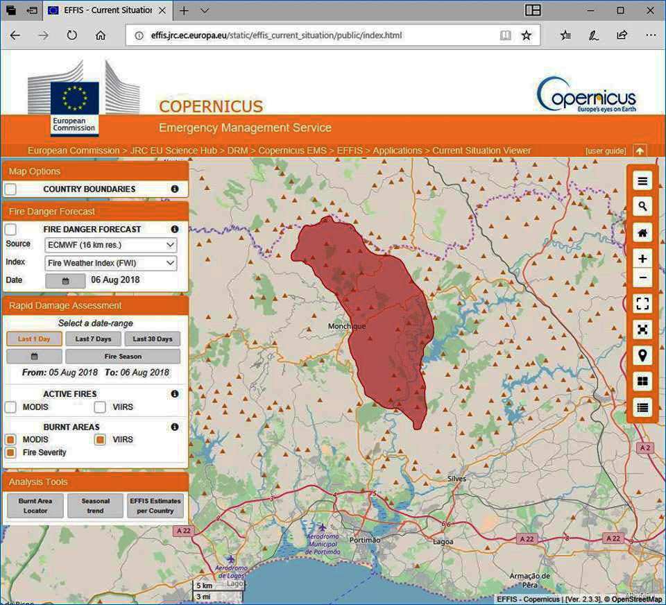
Nearly 13 thousand hectares already burned: these are the numbers provided by the territorial mapping, carried out through the European Union (EU) emergency satellite navigation system Copernicus.
Portugal has addressed to the European Commission a request for territorial mapping, through Copernicus. The data obtained, with an area that can be seen on the map, refer to the situation until yesterday. Today the fire has already progressed, namely during the night, consuming a few thousand more hectares.
The EU emergency satellite navigation system Copernicus is a European program for Earth observation and is based on a partnership established between Brussels, the European Space Agency and the various Member States.
Copernicus' main objective is to provide services that allow timely access to accurate and reliable data and information on the environment, civil protection and citizen security.
The fire, which started in the Serra de Monchique at 13:30 pm on Friday, the 3rd, at the Perna da Negra site, near the border with the municipality of Odemira, has since progressed for dozens of kilometers.
He climbed the mountain, along the EN266, until he was at the gates of Monchique, a village that last night was almost completely surrounded by flames. Yesterday, there was also a front that advanced northwards, entering the municipality of Odemira.
In Monchique, the flames crossed the valley, crossing to the Picota hill, then descended the south slope towards Alferce and Fornalha, crossed the Odelouca dam, and now heads east to São Marcos da Serra. From Picota, the fire still descended to the southwest, towards Caldas de Monchique.
At the moment, the fire has two fronts, one moving towards São Marcos da Serra, the other in the Caldas area, and is being fought by 1111 workers, with 324 vehicles. There are eight air assets deployed, but the intense smoke is not letting helicopters and planes fight the flames.
Also due to the lack of visibility, it was difficult to assess the areas affected by the fire by the authorities, which in the early morning carried out a reconnaissance flight over the Monchique mountains.


Comments