Think about this, dear reader, especially if your profession is teaching: it is a general and well-rooted idea that rivers rise in a well-defined place.
I knew them by heart for all our rivers, five in Spain and the rest in Portugal. I learned them, like, in my 4th grade (the current 4th year) and, woe to me, if I didn't know how to recite them, from Minho to Guadiana. The ruler in the teacher's hand was there waiting for those who did not respect the rule at that time and the rule was to know everything “on the tip of the tongue.”
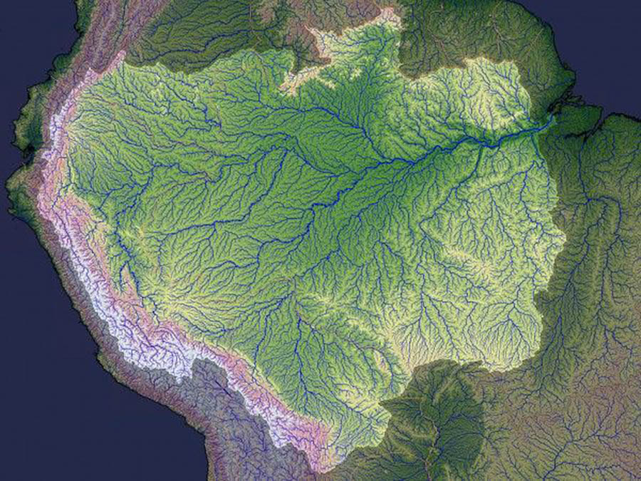
In my opinion, any river, big or small, has not one but countless sources.
I went to see in books and on the net what is still being said about this topic. In the case of some of our rivers, it can read:
The River Minho rises in the Serra de Meira, in Spain, in Galicia;
The Lima River has its source in Monte Talarinho, in Spain, in Galicia;
The Douro River originates in the Sierra de Urbión, in Spain;
The Mondego River rises in Serra da Estrela, at the Mondeguinho site;
The Tagus River rises in the Serra de Albarracim, in Spain;
The river Sado has its source in Serra da Vigia (Ourique);
The Guadiana River has its source in Lagoas de Rudiera, in Spain.
Faced with this reality, the teacher has to explain to the students that this notion of the source of a river is an idea that came from geographers and explorers of the past, without scientific support.
It is a conventional idea that denies reality. In line with this idea, it was agreed to “place” the source of the river in the farthest of the numerous headwaters of the respective hydrographic network. It is the one, we can say, that “makes” the river longer.
In reality, the river receives all the water that falls into its watershed. This water is all that flows on the surface of the slopes (runoff water), that which runs channeled at the bottom of the valleys of tributaries and sub-affluents, and also all that infiltrates the terrain of the respective area that feeds the aquifers and springs here and there in innumerable springs.
Notes:
Hydrographic network – set of the river plus its tributaries and sub-tributaries.
Hydrographic basin – area where precipitated water is conducted to a hydrographic network, that is, the total area drained by a river and its tributaries and sub-tributaries.


Comments