Having proposed to me the elaboration of a photographic work whose theme falls on the immense geological diversity of the Algarve region, this desideratum compels me to once again (I had already done it with popular architecture) to go through the natural space with the camera photographic.
If there are reasons that impel me to descend to the depths, others take me to the highest spaces, from the fringe coast to the mountainous areas, from sedimentary sands, to sandstones, to limestones, to schists.
So, having in my extensive list a mythical place called “Angular discordance of Praia do Telheiro”, I decided to go to Sagres.
I write mythical because, several times, I had already tried to go there (after having seen a few and rare images) and, the only time I managed to do so, in the company of a Friend, it was still morning, making it impossible either to have a good view or a subsequent good image taking, as the area, in addition to being in the shadow of the shadow, was also backlit.
Arriving at the Sagres roundabout, take the Ecovia do Litoral, aka Nacional 268, turn right towards Cabo de São Vicente.
About 3.500 meters later, in a slim possibility of discovering the territory (before the farol of Cabo de São Vicente), turn right again, relegating both the numerous buses on tourist pilgrimages and the Babylonian targets and bodies that jostle together in the best selfie scenarios.
A double kilometer straight, after a small curve and counter-curve, extends to a semi-abandoned hill and part in ruins, named Vale Santo, where an agricultural exploitation still persists.
Months have passed since a previous visit to the area and, by that time, I had not noticed new fences that make it almost completely impossible to park a vehicle. Fortunately, I managed to park it among ruins.
At home, the day before, at Google Earth, I had noticed that, from the end of the tarred road, it would be possible to drive along the dirt road until very close to the place where I wanted to capture some images of Praia do Telheiro, however, bearing in mind that I was in the territory of a Natural Park and having time before the retreat of the ocean – allowing my slow progression along the rocky fringe to Ponta dos Ouriçais, where the Geomonument of Praia do Telheiro is visible in all its amazement – I chose to do it on foot.
First, I wanted to take a route that would put me at a point where I could have a perception of the area where I was interested, placing it on a broader plane and allowing the reading of the specifics of the terrain.
So, with your back to the tarmac, after having parked the vehicle, you turn left on a small rise of land and shortly after that again take the first left, in a progression to the south of Praia do Telheiro.
More or less a kilometer of easy progression between fenced lands with electric fences to contain livestock and warnings written in English to dissuade anyone who wants to take a shortcut.
Once the property limits, which will correspond to the disposition of the most fertile cereal lands and bare pasture lands, have passed, the green spots spread and grow, which find in the aridity of the land enough nutrients to germinate, but not growing very much in height, but rather and in some species, developing horizontally, as the almost always permanent and stiff wind conditions it.
Always guided by previous trips to the territory, a kilometer more will have passed until the moment of approaching the cliff when I thought I was close to the place that would allow the view I wanted to capture.

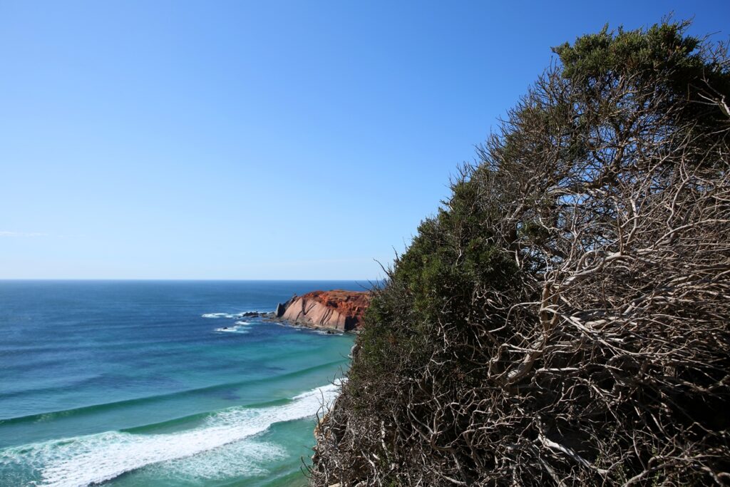
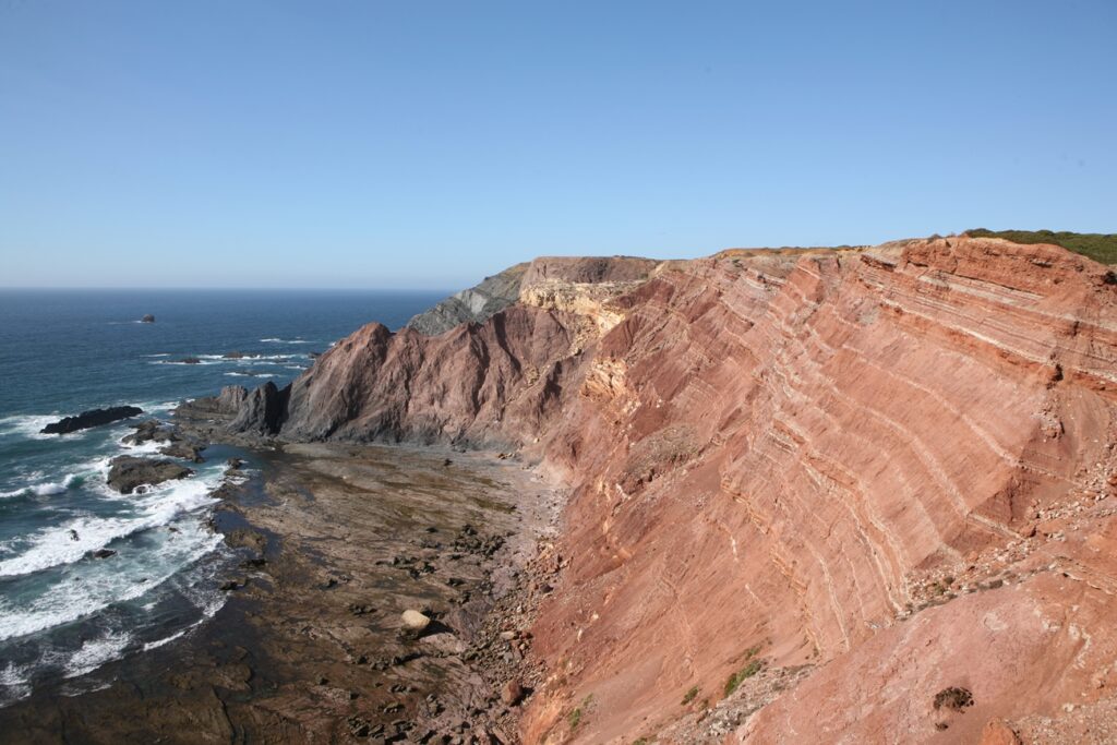
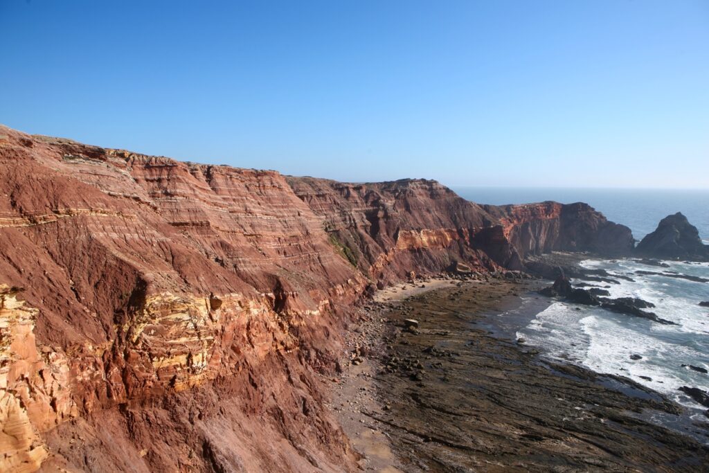
So it happened. Among the fragrant thickets in these first heats of late spring, between the limestone and white rocks that emerge from the ocher earth, I see the blue ocean and, in the background, after a cove and its pristine sand, the northern end of Praia do Telheiro.
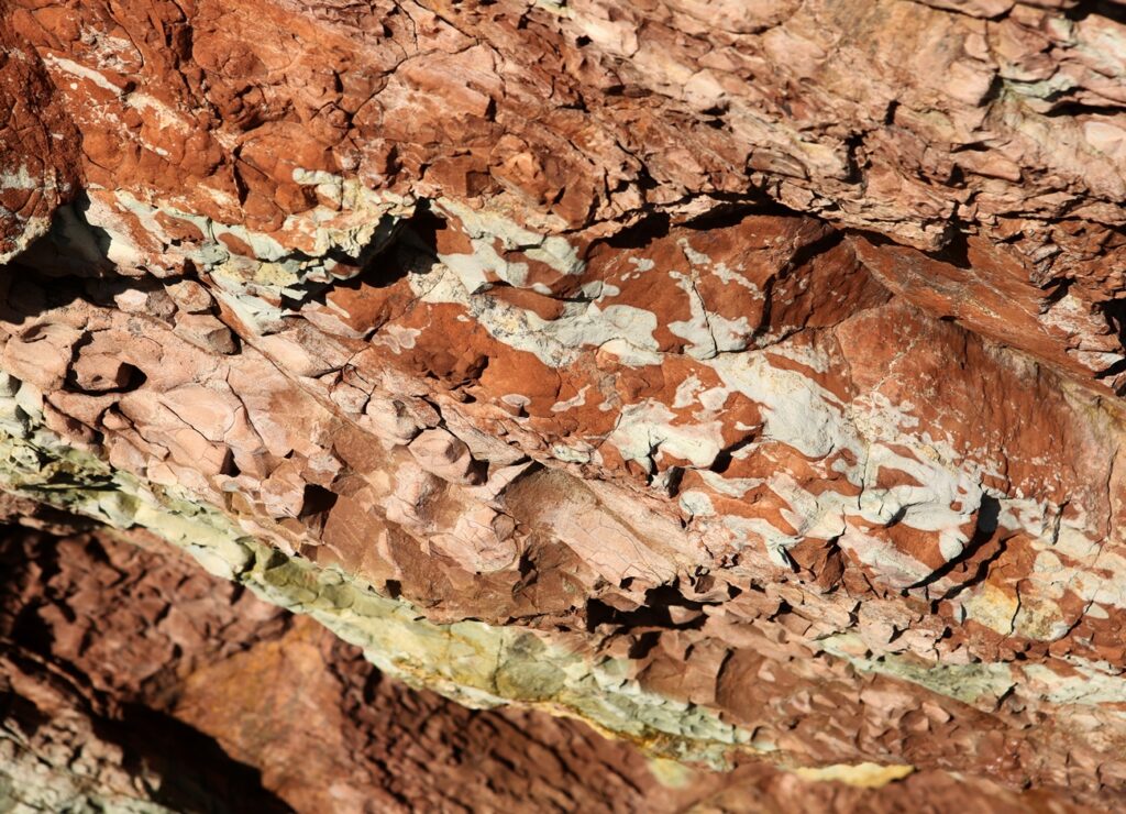
A cliff that, at its end, presents a pearly color as a whole, as the top layer of stoneware, arranged almost horizontally on the grey/black shale and greywacke, when dissolved, lends its color to everything, up to the of surf/tidal; very different in its constituent elements from the place where I find myself, from which white bones seem to emerge, actually dolomitic limestone that, over millions of years of exposure to the elements, has been eroded, becoming a karst landscape.
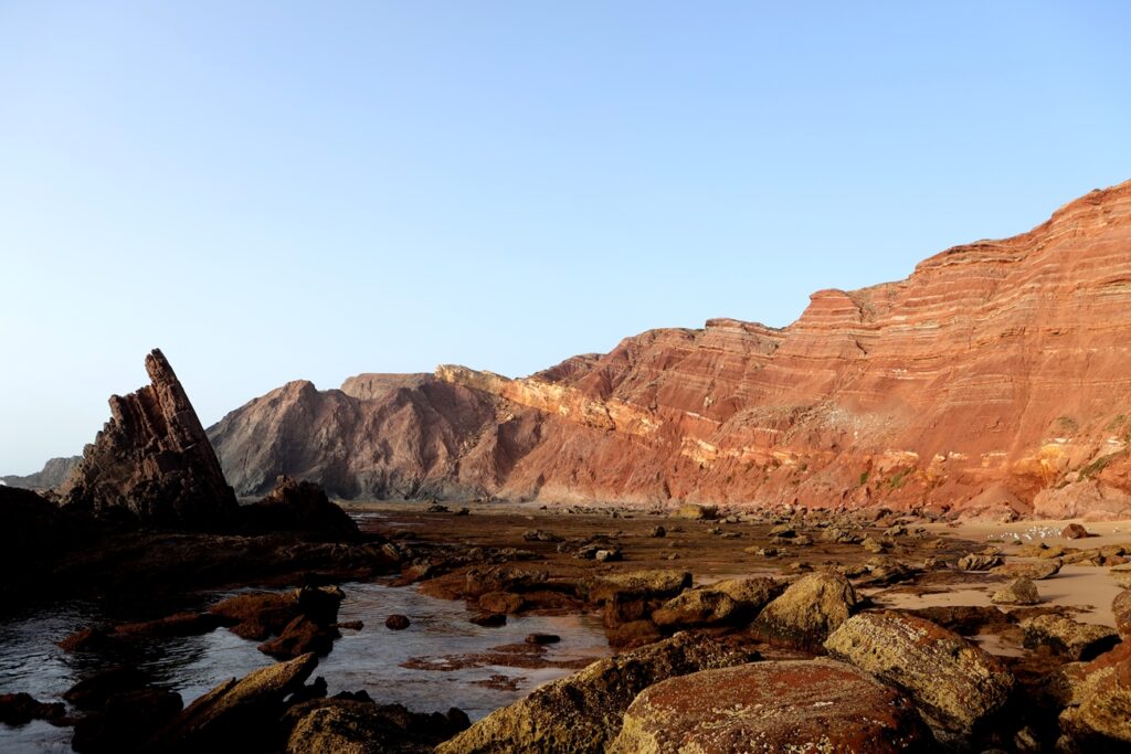
With several pauses determined by the possible frames in the taking of images, making this or that element stand out, I observed that the tide was still very high, still lashing the lower shale, thus making it possible to return to the main path and walk about a thousand meters further to to Telheiro Beach.
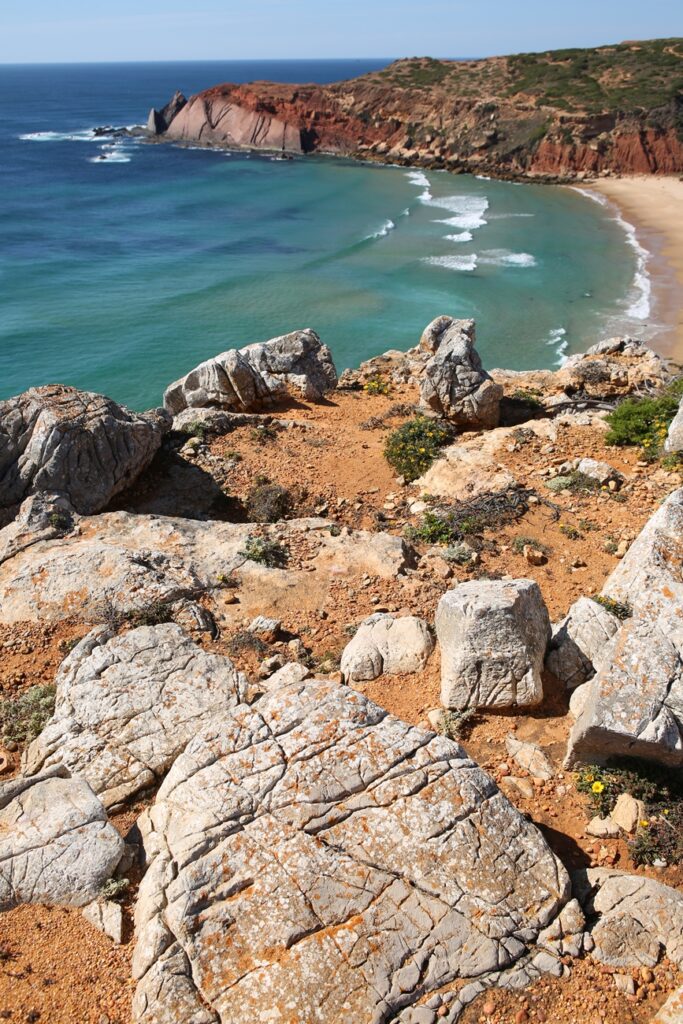
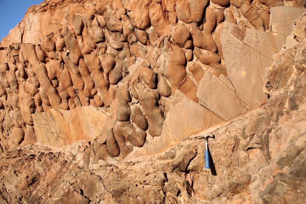
Two girls, appearing from another path, accompanied me on the descent between roots and boulders, new bodies and a Nordic whiteness, in search of exclusive places, stumbling from time to time in the clusters of very compacted detrital rock that were part of an old set of consolidated dunes, in which it is possible to observe cylindrical structures that are nothing more than fossilized roots, which are called rhizoconcretions.
Once on the beach, heading north (on the right) and leaving behind the vision of a massive and towering wall of dolomitic limestone, on the right side, fragmented blocks of compacted sandstone from Quaternary deposits appear, which, due to the erosion of the lower layer, made up of clayey deposits, precipitated on the sand.
A walk of about 200 meters begins, next to the water line. Perhaps this is the most difficult part, as the progression is a little painful between small and gigantic blocks that make you go up and down, advance and then retreat, stop to assess distances and jump, consider whether to pass over or under a block that seems suspended with few points of contact… the hands help to support the body, the legs open at unusual angles, the body swings from side to side to compensate for the natural adornment, the feet confined to boots with sufficient rigidity in their shaft capable of prevent bruises and sprains.
Between stops, whether to assess the effort to be spent, or to rest a little, looking at the irregular cutout of the top of the cliff that already accompanies us, we clearly realize that we are making progress through the material that has fallen from the top.
Once this section is passed, another one with about 300 meters appears, easier in effort, but no less difficult in progression, as it requires attention and short step, since it extends on an intertidal floor, sometimes in the form of stone and oval shapes, sometimes flat, where the green covering the rock is synonymous with poor adhesion.
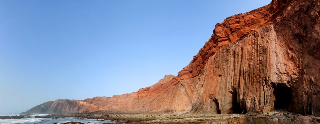
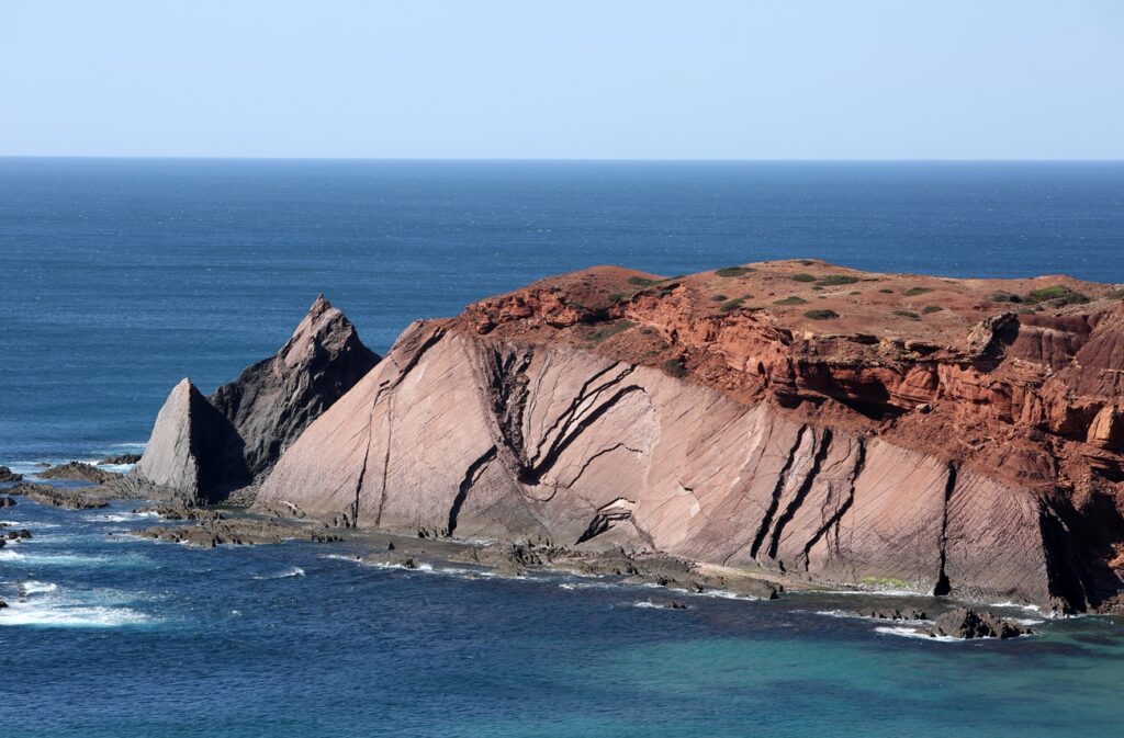
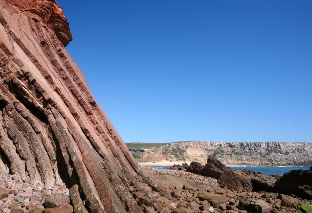
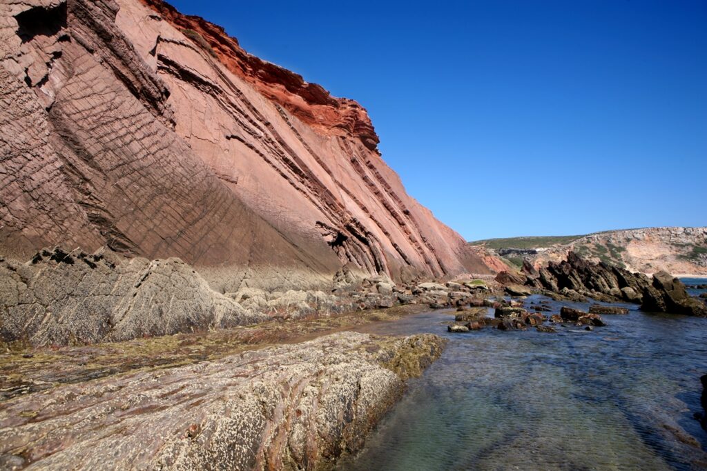
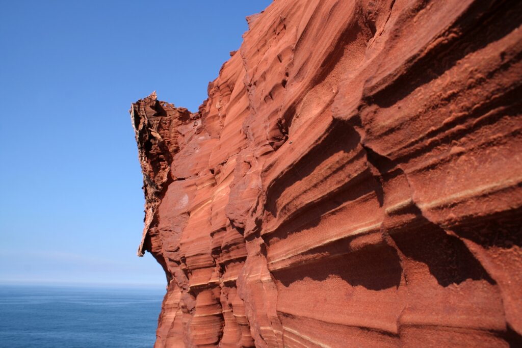
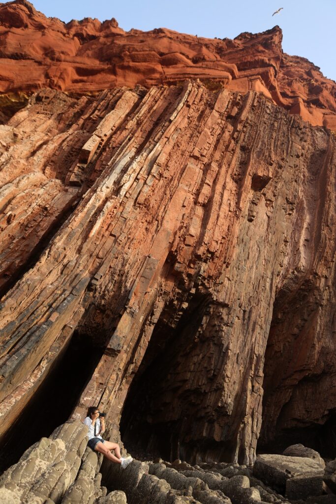
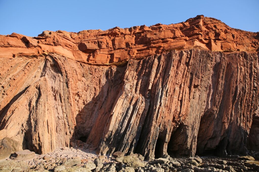
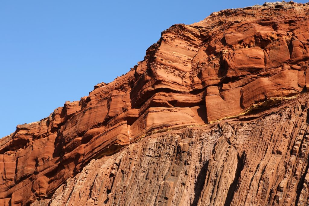
Now the shape of the cliff is different, more upright, without blocks that are suspended over the head. In fact, observing, the constituent materials of the coast are different, an immense and massive wall of overlapping layers of shale is crowned by a horizontal and red layer of sandstone, the sandstone.
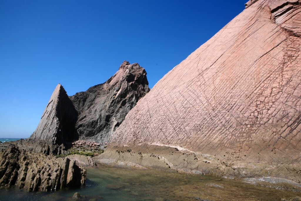
Upon reaching the end of this stage, in a small recess in the cliff, on the right, we notice a separation between this and a block of itself detached at its base by the width of a little more than a foot and that widens in an oblique V.
This block, on the left, formerly belonging to the great land mass, smaller and having already lost its sandstone crown, is now almost completely black in color.
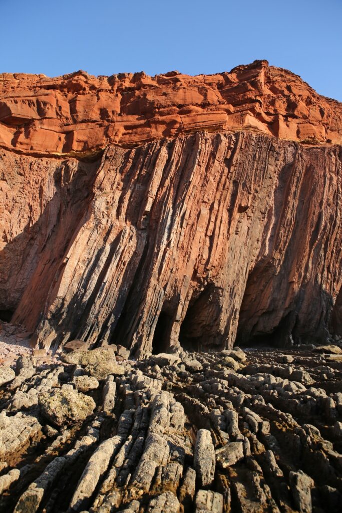
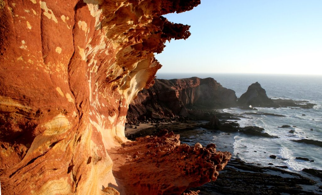
It is through this opening that we must proceed, with no width for carrying a backpack on the back and slightly inclined towards the black rock, we drag a few meters until we reach the entrance hall of Ponta dos Ouriçais, a magnificent inverted portal / amphitheater to Rocha Mãe , for planetary history, for sensory visions of the telluric forces that shaped the earth's surface, joining and separating continents, creating and obliterating oceans, making rock ductile matter at the touch of pressure and temperature.
The steps must continue to be careful and previously studied.
Depending on the individual's sensitivity, a magnetic enchantment is produced through the Sight.
Shapes, colors and textures, which have their meaning, for a layman constitute a tangible testimony of the History of the Planet, because, even knowing nothing, an ancient and telluric meaning of the constituent forces of the Planet is perceived through each pore.
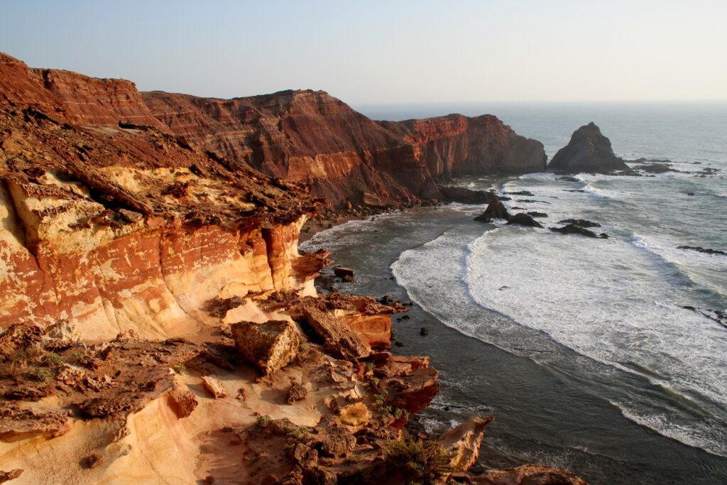
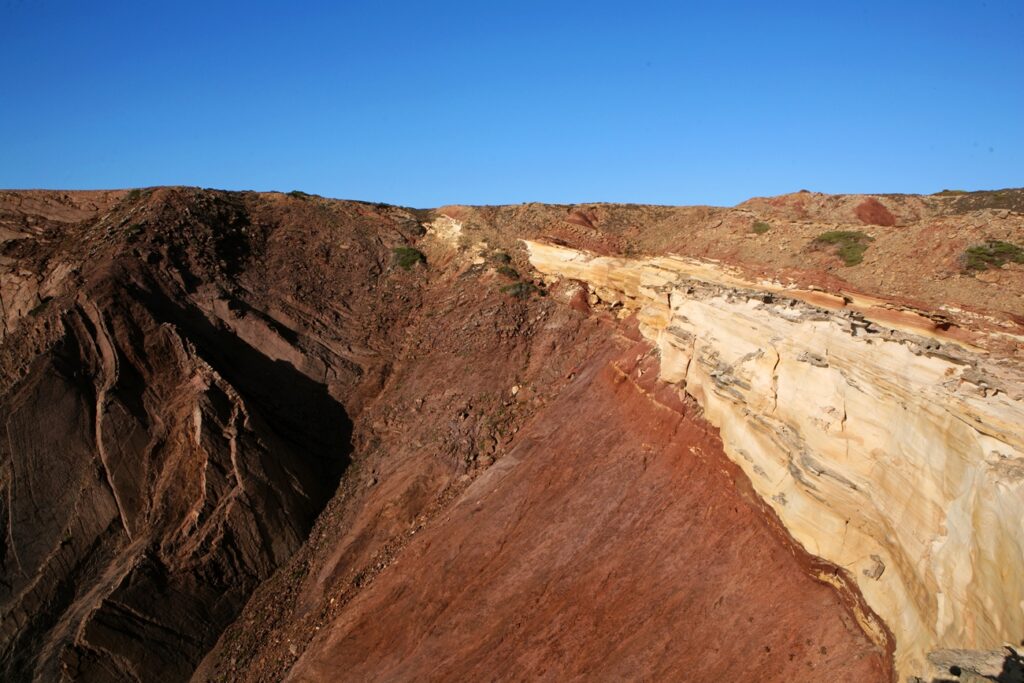
At the top, a more recent layer, corresponding to the Triassic period (200 to 250 million years), constituted by the deposition of detrital sediments, whose existence over time later gave rise to a layer of red sandstone – due to the presence and contact with oxide of iron.
Underneath, in lithological and geometrical unconformity, rock from the Carbonic period (300 to 320 million years), schist and greywacke in vertical strata with folds and faults, stony presences witnessing deformations, metamorphism, uplifts and flattenings.
It should be noted that, between the two layers, there is a gap of almost a hundred million years (difference between the mentioned values), whose non-existence is also a factor that contributes to its constitution as a reference, an element of study on a global scale.
Once in this space, either because of the scenic landscape that dominates us, or because of the desire to look for the best angles that constitute testimonial images of the Amazement, the temptation to stay longer than possible attracts and makes the clock stop.
Access, for those who wish to take a risk, should be made on days with greater tidal amplitudes, because the lower the tide, the easier: both the path, the possibility of retreating to take images, and the time available.
It should be noted that even with a low tide of great amplitude, everything still depends on the wind that blows and the wave that rises, expanding the domain of the ocean which, in these parts, is not usually gentle.
To all this combination of various elements, we must add the fact that such displacement, preferably, will have to occur at the end of the day, from the month of June, because that is when the arc of light provided by the star king is greater, allowing the illumination in the middle of the geological formation further north.
Thus, in view of so many and such difficulties in accessing the North outcrop, there is the possibility of viewing/photographing it from the top of the cliff (located at the north end of the bay, in Ponta dos Ouriçais), facing south; the outcrop located further south, closer to Praia do Telheiro, is also difficult and dangerous to access, I recommend taking images from the beach or from the top of the cliff that rises to the south of it.
On several occasions, it was necessary to remove people from the mentioned area with the helpful assistance of firefighters, who should be included in the telephone book and contacted as soon as possible (from the moment you go down to the beach, there is no longer coverage, at least on my network).
Despite being located in the Sudoeste Alentejano e Costa Vicentina Natural Park, its classification is urgent for its study, conservation and maintenance of its integrity.
Despite the difficulty of the path being an obstacle for those who wish to take any souvenir with them on their way back, visual and sensorial memories should not be allowed any more and that their tangibility only takes place through the intermediary of printed images.
In addition to the rubbish (essentially plastic) that accumulates at the bottom of the caves uncovered in the ebb tide, ropes hanging from the cliffs are visible at various points, used by fishermen and shellfish gatherers, attached at the top to irons hammered down the cliff, opening new fissures and accelerating erosion.
Photos: ©Filipe da Palma

More information: https://geossitios.progeo.pt/geosites/praia-do-telheiro
Author Filipe da Palma is a photographer, who has documented, through his work, the most original aspects of the Algarve's vernacular architecture, as well as inventorying the Algarve's intangible heritage in images, he is the author of the book «Platibandas do Algarve».


Comments