As in so many situations that we face in our day-to-day, earthquakes are also unpredictable and do not “warn” when, where, or with what magnitude or intensity they will occur. This brings us to the question of magnitude and intensity, which are still often confused.
But before we address this issue, it is necessary to mention that our country is the stage for these types of geological events, with epicenters on land or in adjacent areas. Every day, the Portuguese Institute of the Sea and Atmosphere (IPMA), which is the national entity responsible for seismic monitoring in our country, makes available on its website the location of the earthquakes that occur in national territory and respective magnitudes.
Most of these telluric events are of low magnitude and mild to moderate in intensity. So let's get back to the question of magnitude and intensity, and let's make a brief explanation.
The magnitude of an earthquake is obtained through mathematical calculations based on the analysis of the seismogram. The magnitude then reflects the energy that was released when the rupture occurred in the earth's crust that caused that seismic event. To quantify the magnitude of an earthquake, the Richter Scale is used, which is a logarithmic scale of base 10. This means that each time you increase a point on the scale, the energy released when that event is generated is 32 times greater than the of the previous degree.
For example, an earthquake with magnitude 5.0 would be generated by a disruption 10 times greater than an event with magnitude 4.0, and would release 32 times more energy than the latter. This brings us to a new question: what is the energy released in an earthquake? If we consider an earthquake of magnitude 3.0, the energy released in that event is the equivalent of the energy released when making an explosion using 1800 kilograms of explosives.
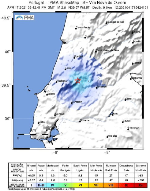
Is it rare events with magnitude 3.0? Not really! For example, just this year, up to this date, in mainland Portugal two events of this magnitude have already occurred. However, the Richter Scale has yet another peculiarity, it is an open scale, that is, it has no upper limit.
To date, the earthquake that occurred in Chile on May 22, 1960 is the one with the greatest magnitude recorded, having had a magnitude of 9,5. However, it is not known what the maximum energy released in a single rupture in our planet's crust might be!
Now that we've talked a little bit about the magnitude of an earthquake, let's talk a little bit about the intensity of a telluric event. The intensity of an earthquake is related to how it was felt and what effects it caused.
In this case, the 1956 Modified Mercalli Scale (called MM56) is generally used. This scale is a closed scale and has 12 degrees of intensity, with degree I being given to an earthquake unnoticed by people, and degree XII to an earthquake that causes almost total damage.
In order to be able to attribute a certain intensity to a telluric event, it is necessary to contact the populations that experienced this earthquake in order to obtain testimonies of what they felt and what effects were observed.
Returning to our country, every year, only a tiny percentage of the earthquakes recorded by the national seismic network are felt by the populations. However, since the beginning of this year, several inhabitants of localities on the Portuguese mainland have experienced earthquakes, albeit with moderate intensity, that is, they did not exceed grade IV (MM56), according to the IPMA.
In this case, populations felt a vibration similar to that caused by the passage of a lorry, they may have noticed the windows, doors and tableware shaking and observed suspended objects swinging (ex. chandeliers). But in the case of intensity, the closer we are to the epicenter, the greater the intensity, decreasing with distance due to the loss of energy from the seismic waves.
Author: Ana Gomes, graduated in Geology from the Faculty of Science and Technology of the University of Coimbra, Master in Volcanology and Geological Hazards and Ph.D. in Geology (specialty in Vulcanology) from the University of Azores.
She is a researcher at the Earth and Space Research Center of the University of Coimbra and at the Department of Earth Sciences of the same university (DCTUC), where she develops research in the scope of the analysis of seismic data from the COI seismic station of the Geophysical and Astronomical Observatory of the UC (OGAUC) and develops actions to disseminate science. She is co-coordinator of the “Escolas Associadas” project at DCTUC and collaborator with OGAUC.
![]()


Comments