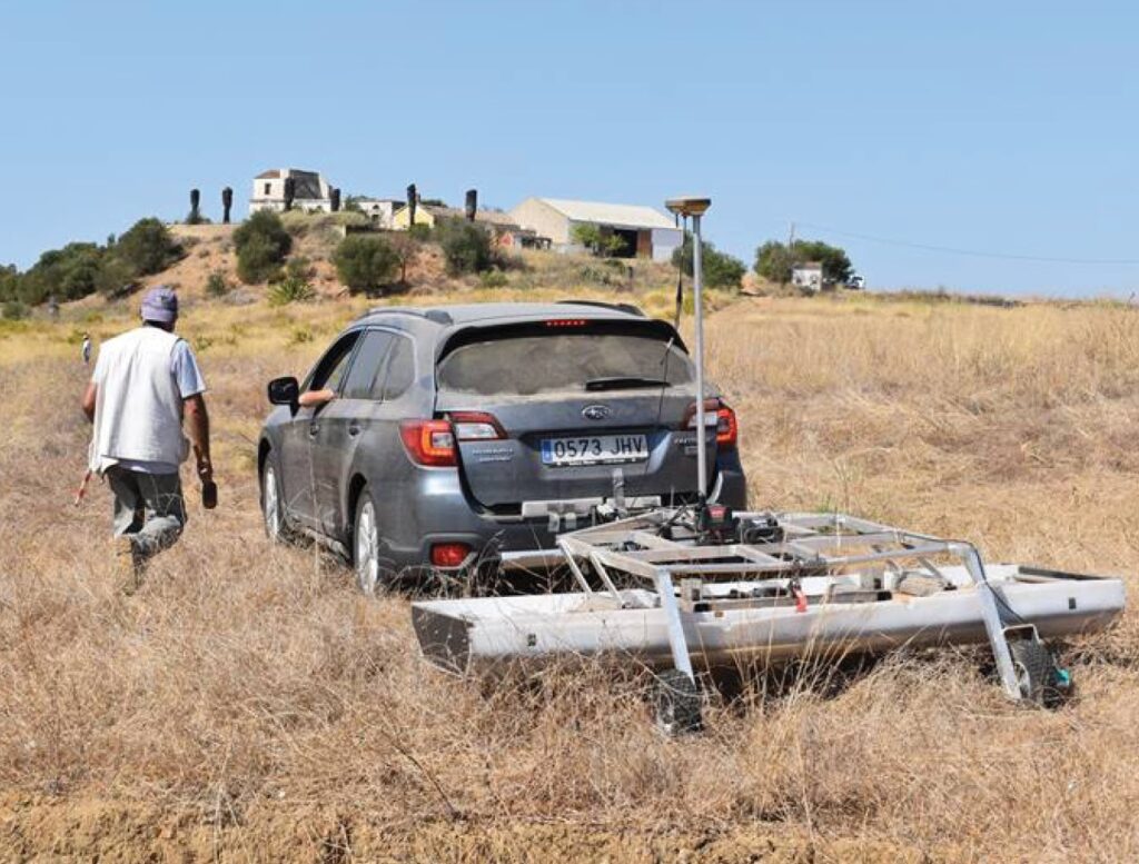
A team of researchers from the University of Cadiz geodetection unit and the University of the Algarve has been carrying out geophysical surveys with a georadar at the archaeological site of Balsa, in Tavira, to help better understand the Roman city that existed there some 2 years ago.
For a week, "several hectares of terrain were tracked with a state-of-the-art multi-frequency 3D ground penetration radar (3D georadar)."
«This state-of-the-art equipment will make it possible to have three-dimensional images of the subsoil, detecting buried structures and other Roman constructions, their configuration and the depth at which they are located», according to the University of Algarve.
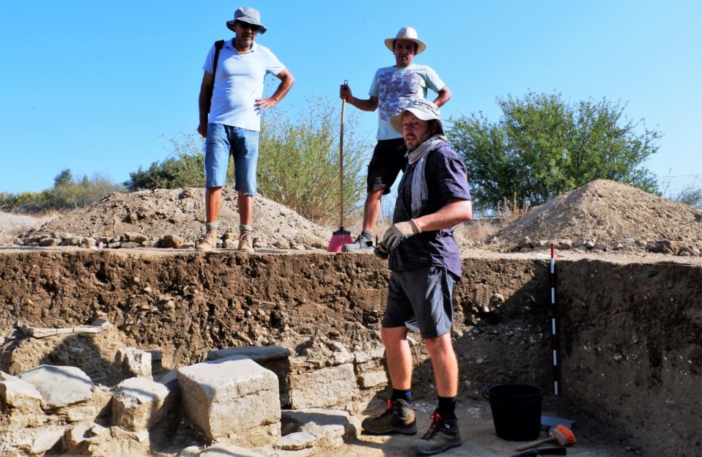
This summer, due to Covid-19, the planned excavations were not carried out, which would continue the field work started last year, under the scientific project “Balsa, Recovery and dissemination of a Roman city in the Iberian Southwest – Cultural project for social cohesion and local sustainability”, jointly promoted by the Regional Directorate of Culture of the Algarve (DRCAlg), by the University of Algarve and by the Municipality of Tavira.
In the first of three years of this scientific investigation, archaeologists found some promising clues, which helped to understand a little better this mysterious Roman city, located inside the Quinta da Torre d'Aires.
This year, investigations were carried out for the first time in some lands of the former Quinta das Antas, «where archaeologists suspect that a large spectacle building may be located, referred to in two inscriptions from there that refer to the existence of a circus».
“For the first time, archaeological research was carried out on the hill surrounding the farmhouses of Torre d'Aires, the central nucleus of the Roman village,” added the UAlg.
In practice, the scientists X-rayed the subsoil, “passing the 2,7 meter wide georadar device attached to a 4×4 vehicle through the surface”.
This research “was only possible due to the good will of some landowners located on the Torre d'Aires farm and the source of this farm, who joined the project, allowing this type of non-invasive archaeological work to be carried out on their properties”.
The results of the field survey carried out by a team of 5 researchers from the University of Cádiz, led by professor Lázaro Lagostena Barrios, accompanied by project coordinator João Pedro Bernardes, from the University of Algarve, and by the archeologist from the municipality of Tavira, Celso Candeias, will be known in November, "after a complex process of filtering and analyzing data by sophisticated software."
«The results of this work will bring a significant advance in the knowledge of what still exists in the city, in the way its urban planning was organized and the type of buildings that existed there», believes the University of Algarve.


Comments