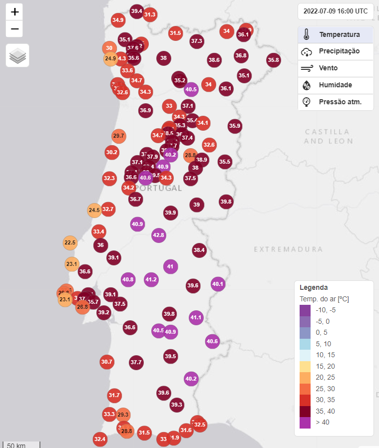
The heat wave that mainland Portugal is going through «has not been, so far, so exceptional due to the values of the recorded maximums, but more due to the persistence of these same values over many days», and will continue throughout this week.
The statement is from Bruno Gonçalves, environment engineer and responsible for the sites Meteophons e extreme atmosphere, who stresses that «we have the possibility that, this coming week, temperatures will continue to rise, with 45ºC or 46ºC being recorded in some places (or even higher), a situation that will probably justify the issuance of a Red Warning for some districts» . In addition, the minimums, namely during the night, will also be around 30ºC in many places.
Bruno Gonçalves adds that, «for those more “skeptical” about the existence of Climate Change and for the fact that this situation is normal or not in the summer», the published graphs (see below) «demonstrate, without much room for doubt, that at least less since the last century, we have a well-defined trend of increasingly hotter and drier years».
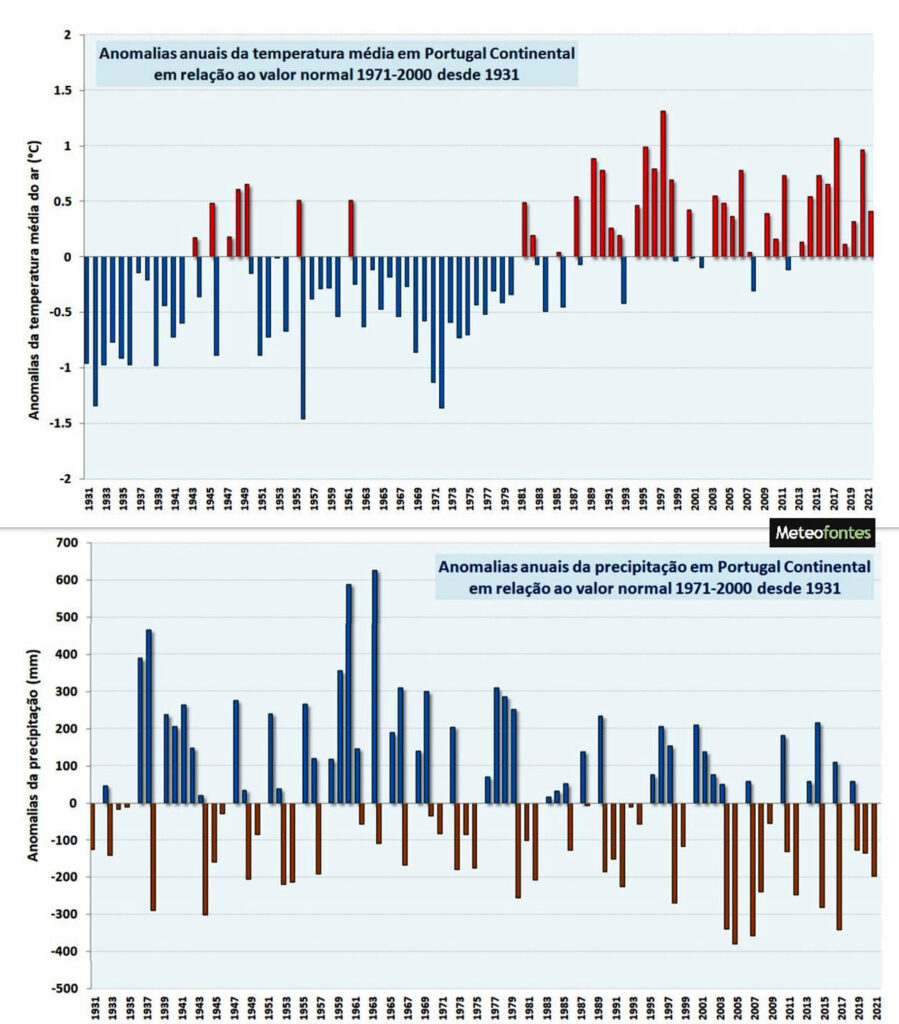
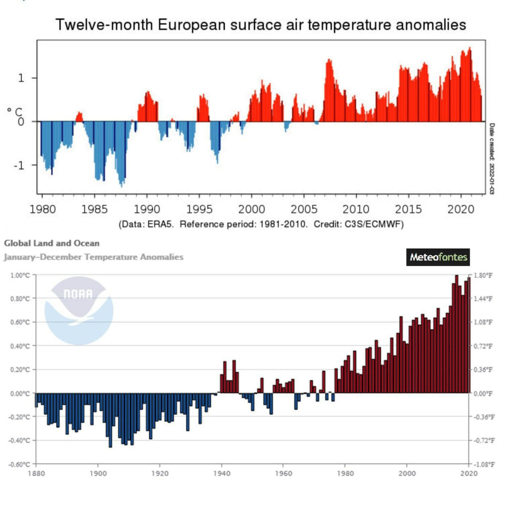
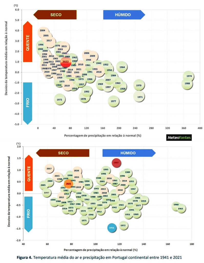
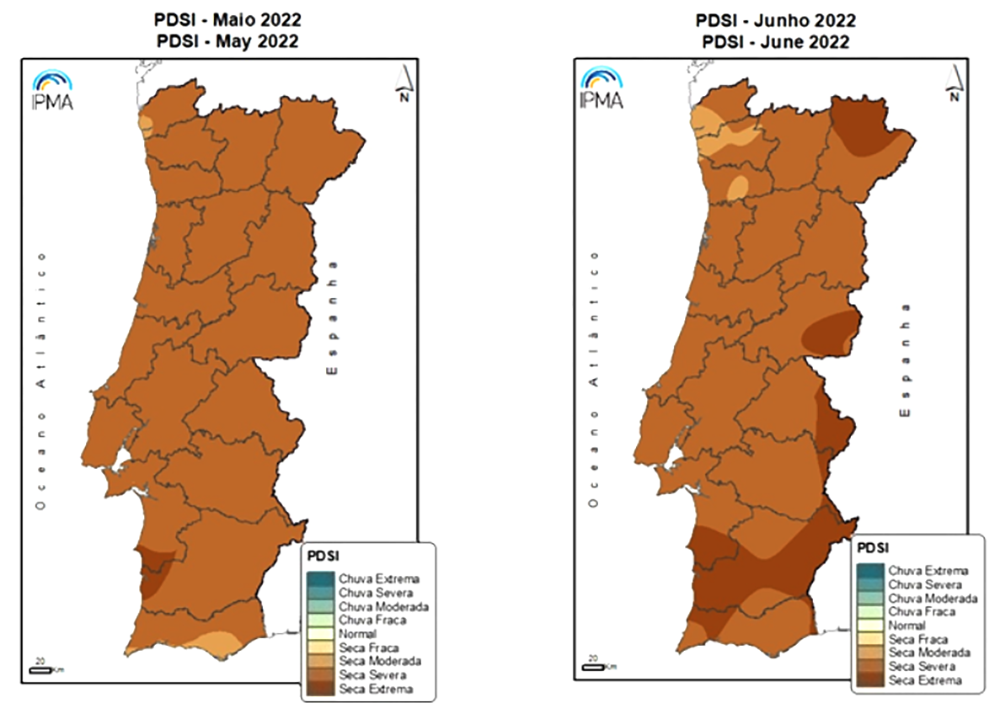
The graphs indicate that «we have had more and more years with positive average temperature anomalies (temperatures warmer than Normal), in these last decades».
On the other hand, «also the negative precipitation anomalies (with precipitation below the Normal) have been verified with increasing frequency in the last decades».
And this, he explains, happens both in Portugal, in Europe and in the rest of the world, with «a clear trend towards increasingly hotter and drier years».
The graphs that the specialist publishes are generated by data from IPMA, NOAA and other official entities.
«But even with the data that I have registered in the weather station at Sitio das Fontes (Algarve), since 2009, this same clear trend has also been observed: increasingly hotter temperatures and increasingly drier years».
Therefore, the Environmental Engineer recommends «a lot of attention to these coming days, which will continue to be as hot or warmer than the last ones».
Even if values of 45ºC, 46ºC or 47ºC are not reached, “it will always be a very severe situation and with clear effects at the level of human health, at the level of ecosystems and, we hope not, at the level of fires”.
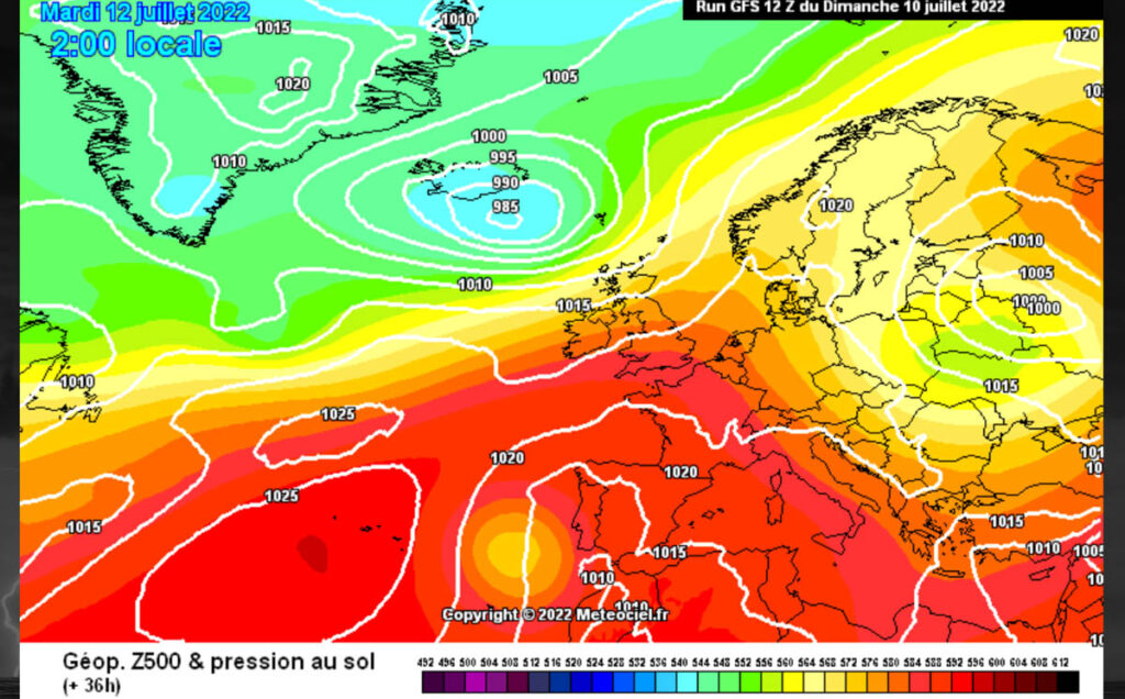
The heat wave that we are experiencing is caused by an anticyclone located to the NE of the Azores and extending in crest to the British Isles, in conjunction with an isolated depression in height, which will pass west of the mainland, but away from , causing an eastward flow over mainland Portugal, “pulling” very hot air from North Africa towards Portugal.
Maximums may reach 46/47ºC in some places in the Tagus Valley and Alentejo interior, and minimums will also be high, around 30ºC on some nights in the North and Central interior.
Click here for detailed weather forecast


Comments